-
Posts
888 -
Joined
-
Last visited
Everything posted by dtarin
-
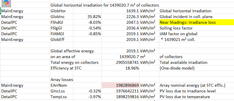
EarrNom and all resulting energy are not shown correctly when exporting loss diagram values from the report. The report itself is correct, but the exported values are not.
-
The 1100UD is one inverter module that is typically installed with other modules in a single PCS, like the 4400UD-MV. You will have four mppts with the 4400, each 1100 is one mppt as stated above.
-
If it still doesn't work you can always model it as I have above 🙂 The gaps will not matter for bifacial calculations, they are not used. The user defines the transparency factor manually which takes into account gaps in structure, modules, etc. So I'd either model as I have or increase the gap in your method if the suggestion above does not work.
-
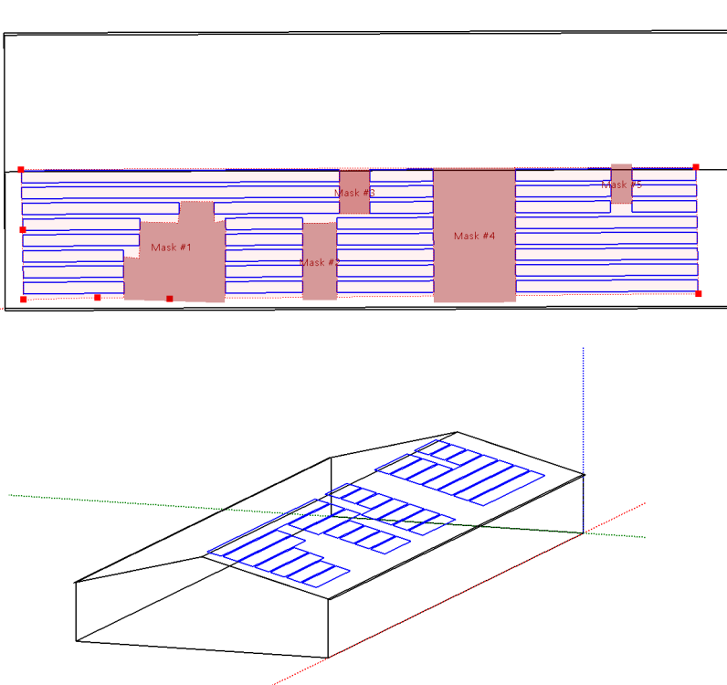
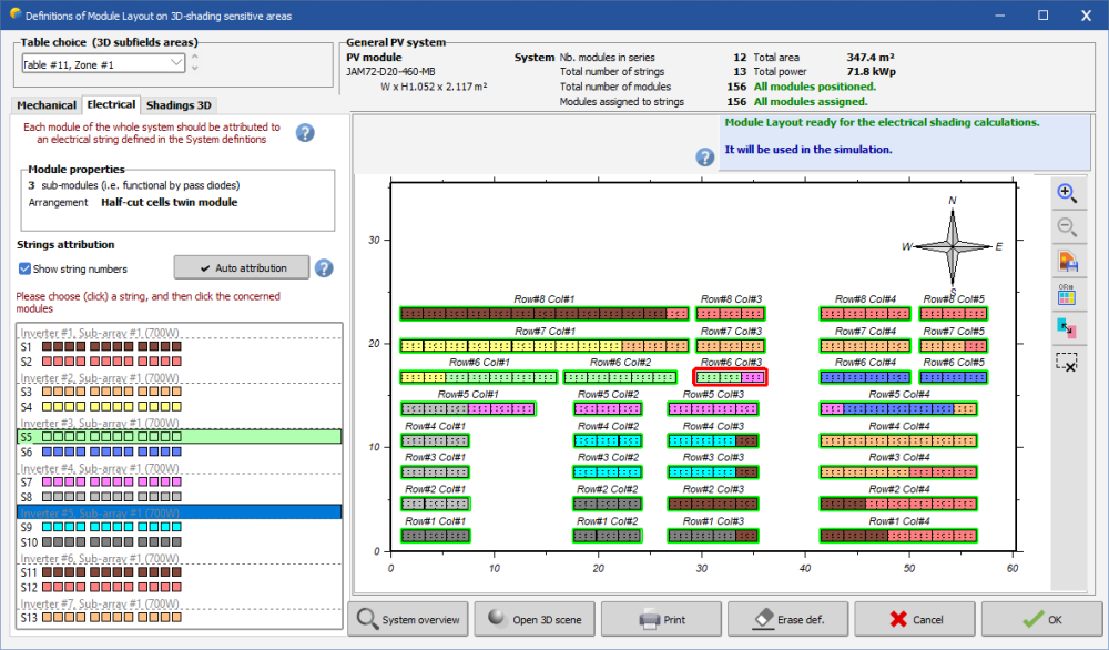
I don't have any the details of this system and haven't modeled solar edge in a long time. However, with a zone you can auto set table to fill the zone, auto tilt to adapt to slope of roof, set table size to 1x1, and then use module layout for allocation (electrical loss). Keep in mind this is just for shading calculation, not power, so you don't need it perfect. As long as it is reasonably close to capturing the shading conditions it should be fine. You create a single zone, insert masks, auto fill the zone as shown. This will allow you to model bifaciality.
-
OND files are for inverters. It is typical to receive from manufacturer if it is not listed in database already.
-
Modifying the OND file is another way
-
While that is being investigated, in the past, these types of issues were caused by the default program assumptions overriding the project settings. The default value is 0.02. In the main PVsyst menu under advanced settings, set the default to 0.00 or 0.01. Import your shade scene where things are showing up correct, save, and reopen to check. The warning about tables not defined by modules is not material in most cases.
-
Reduce the size of the window then maximize again.
-
The inquiry above is related to the inquiry here, which is the slope (tilt) of the table does not follow terrain, only the elevation.
-

Medium voltage line + medium voltage external transformer
dtarin replied to arnaud pancrazi's topic in Simulations
Total loss -
The first section for AC loss should be zero. The MV AC losses are further below, they will not be zero. There is no good way to model it. Modeling with 1 overestimates loss, modeling with 2 underestimates loss. For an in-between figure you can simulate with 1 partition and again with 2, average those and calculate energy delta from your base case, then apply that delta in a new simulation in MQF. For example, base case A is 1 partition, case B is 2 partitions. The two partitions will likely have higher energy. Then calculate (EArrMpp_B - EArrMpp_A) / (2 * EArrMpp_A) and include this result in MQF in a new simulation for case A.
-
For clarification I am not suggesting LID divides by 2. LID occurs on shorter timescale compared to annual degradation and should be taken in full. My overall comment is that taking 1st year degradation from the datasheet and subtracting (annual degradation/2) to get LID may be conservative and something to keep in mind. Different modules may test higher or lower in LID and it is recommended to have module-specific data to support LID assumptions.
-
Lid and annual power degradation are separate degradation modes. They also occur on different timescales. It is common to assume first year annual degradation divided by 2 (as is done in PVsyst). This may be conservative, which could be fine, but may not be ideal in other aspects. For example, most PERC modules are Ga-doped and certain suppliers test quite low on LID (~1%). For most PERC modules, first year degradation is 2%, 0.45% annual degradation thereafter. The method above would add 0.775% loss over what would be expected for the first year. For TOPCon modules if your LID is 0.5%, you'd have an additional 0.3% loss in year 1. Might be fine in some cases but not in others, something to keep in mind.
-
Night losses are everything the plant draws at night, including transformers. The utility does not distinguish between devices. Most utility-scale plants (in my opinion) do not have nighttime disconnects on the MV equipment. The MPT is always connected to the grid. It is best to assume (unless you have a detailed design stating otherwise) that the plant will not be disconnected from the grid at night. The caveat here is that depending on how you are using your energy model and if it is flowing into a financial model, you may want to separate these out in case they are considered independently in the financial model.
-
Transformer losses will come from the manufacturer. If you are modeling transformers in PVsyst, ensure the no-load losses are captured there, and it will reflect in the 8760 for night hours. For MV transformers, 0.10% - 0.16% is a good range for no load losses, for MPTs, 0.04% - 0.06% is a good range. Other items you will need to determine based on plant equipment. 0.2% of POI rating for total hourly night loss at the revenue meter is a good estimate overall (utility scale SAT). Use something higher for cold-weather plants.
-

PVsyst does not show Plane of Array Irradiance AFTER backtracking
dtarin replied to Ahmad's topic in Problems / Bugs
If backtracking is enabled, GlobInc considers backtracking, as does GlobEff, and all other irradiance parameters. -
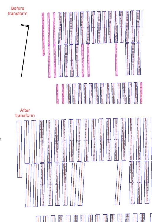
Transforming fixed tilt tables to trackers changes their orientation. It looks like the parameters are being passed directly to the new tracker object like azimuth and tilt, when these are calculated/defined differently for each type of object, and should be recalculated so that the object remains in place.
-
Custom tracker is a better option than central. It reduces simulation time and can approximate very close to all trackers; it just depends on how good of a tracker you select. Simply looking at the scene visually for a location which has a good representation of the site generally works (for larger sites), but smaller, complex sites might take some trial and error. In any case we see <0.1% delta using custom tracker compared to all trackers.
