Search the Community
Showing results for tags 'horizon'.
-
PVGIS horizon imports are currently not working properly as they are only importing 180deg of the horizon from 0deg to 180deg and not including -180deg to 0deg. This is a problem with both 5.2 and 5.3 currently.
-
Hello PVsyst Community, I’m a solar PV designer working on utility-scale projects and looking for an efficient way to import a 3D forest model into PVsyst. The goal is to perform accurate shading and horizon analyses, as nearby vegetation significantly impacts system performance. If anyone has experience or recommendations for importing realistic 3D vegetation or forest models into PVsyst—whether through SketchUp, terrain files, or other compatible formats—I would greatly appreciate your insights. Thanks in advance for your support! Best regards, Carlos
-
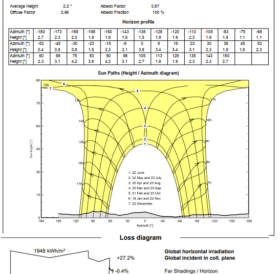
Hello, I have two projects in the same location and the losses horizon shading difference is 1.4%. The horizon profile is similar. In the first, I have the following factors: Albedo factor = 0.87 Diffuse factor =0.96 The horizon losses is 0.4%. In the second, I have the following factors: Albedo factor = 1.00 Diffuse factor = 1.00 The horizon losses is 1.8%. Question: 1) How do these factors affect the shading calculation? 2) How can these factors be defined? 3) Where can these factors be set in PVsyst? Thank you!
-
Hello forum users, i am doing some research on the various Horizon sources available. i have chosen some meteo data i have used for previous projects and i would like to do a series of analysis for each one of them using: 1 - SolarGIS Horizon profile 2 - Meteonorm Horizon (from PVsyst web sources) 3 - PVGIS Horizon (from PVsyst web sources) my goal is to: compare the "far shading losses" and the Horizon line drawings considering the different Horizon data so to have a general overview of the differences between the Horizon datasets; of course my research will also include the study of the manuals and theory behind the definition of the Horizon profile provided by each one of the three Meteo database. i would like to raise a couple of questions: how far has to be an obstacle to be actually considered in the far shadings? considering the high dependency of the horizon from the exact geographical coordinates, are there any suggestion on the horizon profile choice regarding big PV plants? has someone of you undergone some similar studies? have you found some interesting results? also, considering point 2, a question for the software developers: are you considering a possible software update that would allow the user to set different horizon profiles, perhaps linking a single profile to a single subfield? thank you very much in advance for your contribution! Davide
- 8 replies
-
- horizon
- meteo data
-
(and 8 more)
Tagged with:
-
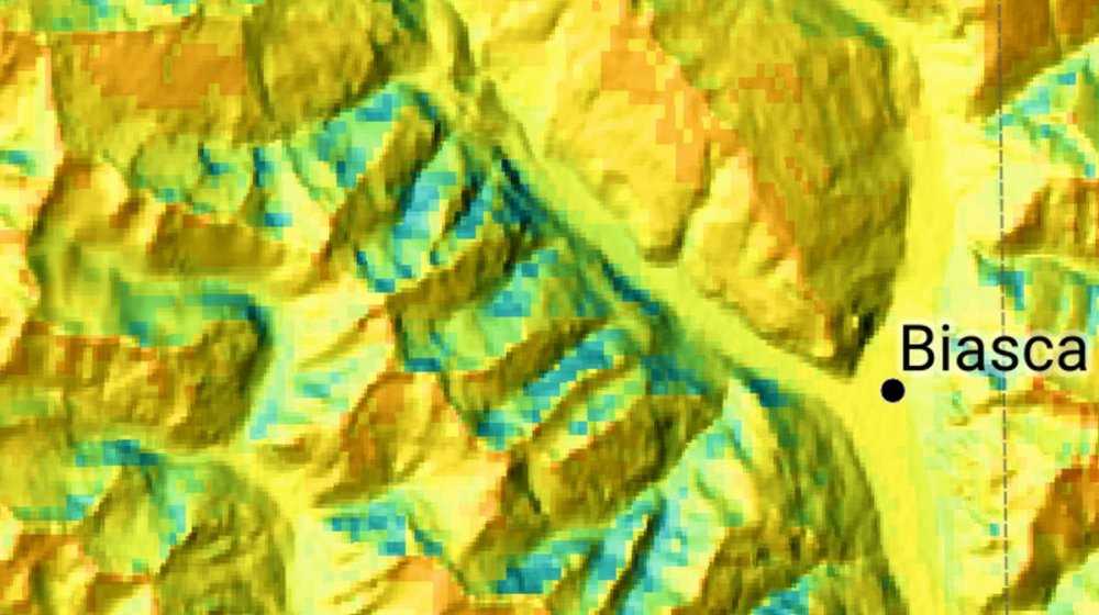
Hi dear Forum users I'm using PVSyst since a while now as a Student, but only now got into the topic of GHI Data generation (and also (synthetic) TMY). I always thought that GHI was calculated on a flat horizon model and has to be considered with the Horizon in PVSyst (subtracted). But when I saw the GHI map from Meteonorm of Switzerland, it seems that this is already taken into account, since north oriented side of a Mountain has much smaller values in GHI than south oriented. Now that I see it, it seems to make sense, but I wanted to make sure I don't miss a point. My thoughts: — When I get the monthly values of Meteonorm, the irradiation seems to already be the effective irradiance to hit this spot on the map, so the horizon has already been considered. — When I generate a synthetic TMY file, it doesn't take the horizon into account and spreads the hours throughout the day, even at times, where there wouldn't be a direct beam. — And when I subtract the horizon with the built-in function, I subtract it again from the data. Do you agree? I'm interested in your opinions. With real measured hourly data it wouldn't make a difference, because the measuring device would not measure a high GHI in the shadow anyway and therefore nothing could be subtracted in the simulation. It still wouldn't be necessary, but wouldn't do any harm. So the problem lies in the synthetic TMY generation combined with the horizon function. I even summed up the whole Hourly TMY to make sure it fits the yearly values. Only the partial near/shading would then be appropriate. Best, Rafael
-
Hi I would like to know if the terrain shadows (far shading losses) are included in the TMY PVGIS 5.1/5.2 imported data when a .SIT is created. Thank you.

.png.8858780cf01ee36b4ce12fc3eb22fa30.png)


