Joe Hollingsworth
-
Posts
12 -
Joined
-
Last visited
Everything posted by Joe Hollingsworth
-
Hi there, I am trying to do batch runs with Pitch and number of strings as my variables. In the "plane orientation" tab. There is no option for pitch as a variable. I am used to seeing in there. I suspect this may be an issue with the orientations manager? Is there anything that would prevent pitch as being an option on this tab?

-
Importing Ground Image
Joe Hollingsworth replied to Joe Hollingsworth's topic in Shadings and tracking
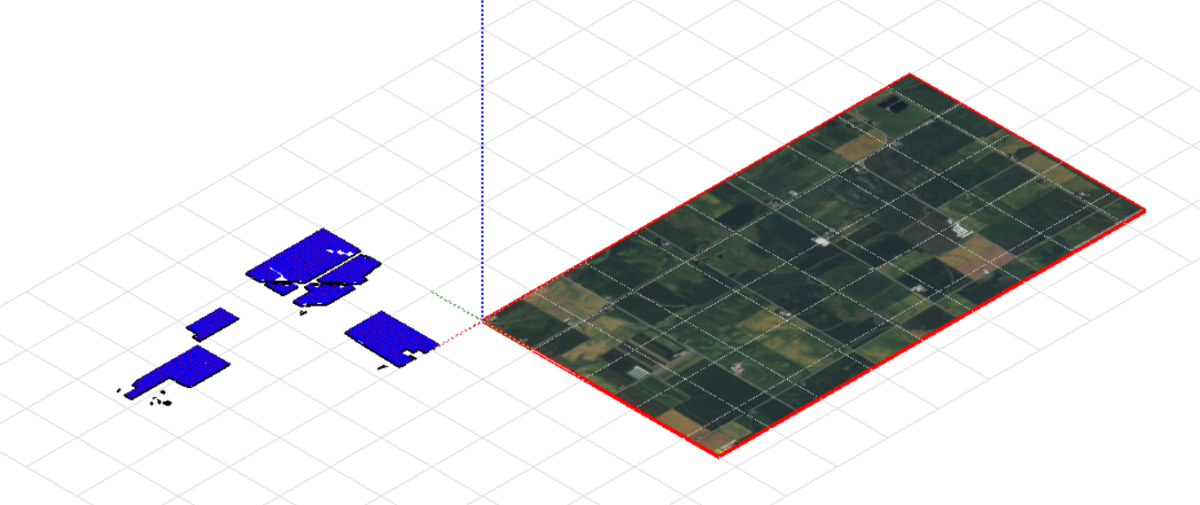
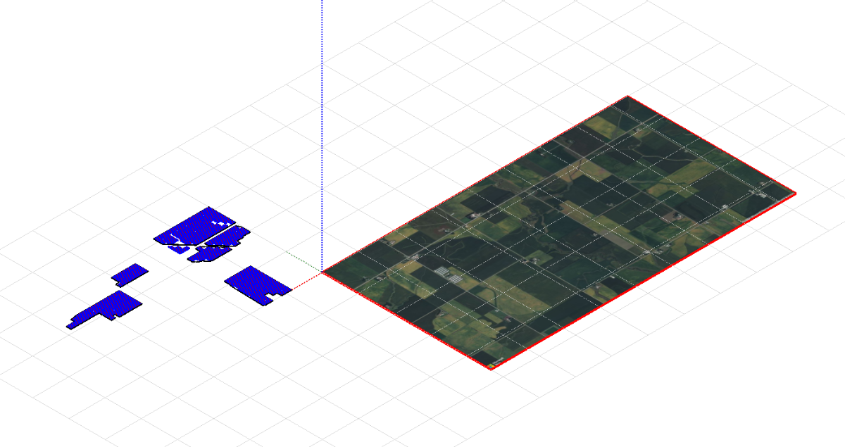
Okay, I added some tree lines, and when I used 0,0,0, for the translation this is what came up. When I apply the automatic translation, this is what happens: Does this have something to do with the geogrpahical site location? It seems that the interactive map that pops up to download does not allow me to go to the aerial location of the project. I'm not sure if this has to do with a lat/long of the geographic location or when inserting the image. Let me know if you have any suggestions, and thank you as always @dtarin.
-
I am trying to use PVSyst v 8.0 to import a ground image. I first imported a shading scene from PVCase, then went to file>import>download satellite image. This resulted in a location near my project, but seems to be off. Do you have any advice on how to line up the satellite image with my actual project?
-
System Sub-Array and 3D Field Size
Joe Hollingsworth replied to Joe Hollingsworth's topic in Shadings and tracking
Understood, thank you for the advice! -
System Sub-Array and 3D Field Size
Joe Hollingsworth replied to Joe Hollingsworth's topic in Shadings and tracking
Okay so your guidance would be to (a) ignore this error or (b) remove trackers until they are equal? Just to confirm I am not missing something, is there a way to apply a specified number of modules to a selected group of fields, similar to how that can be done with partitions?
-
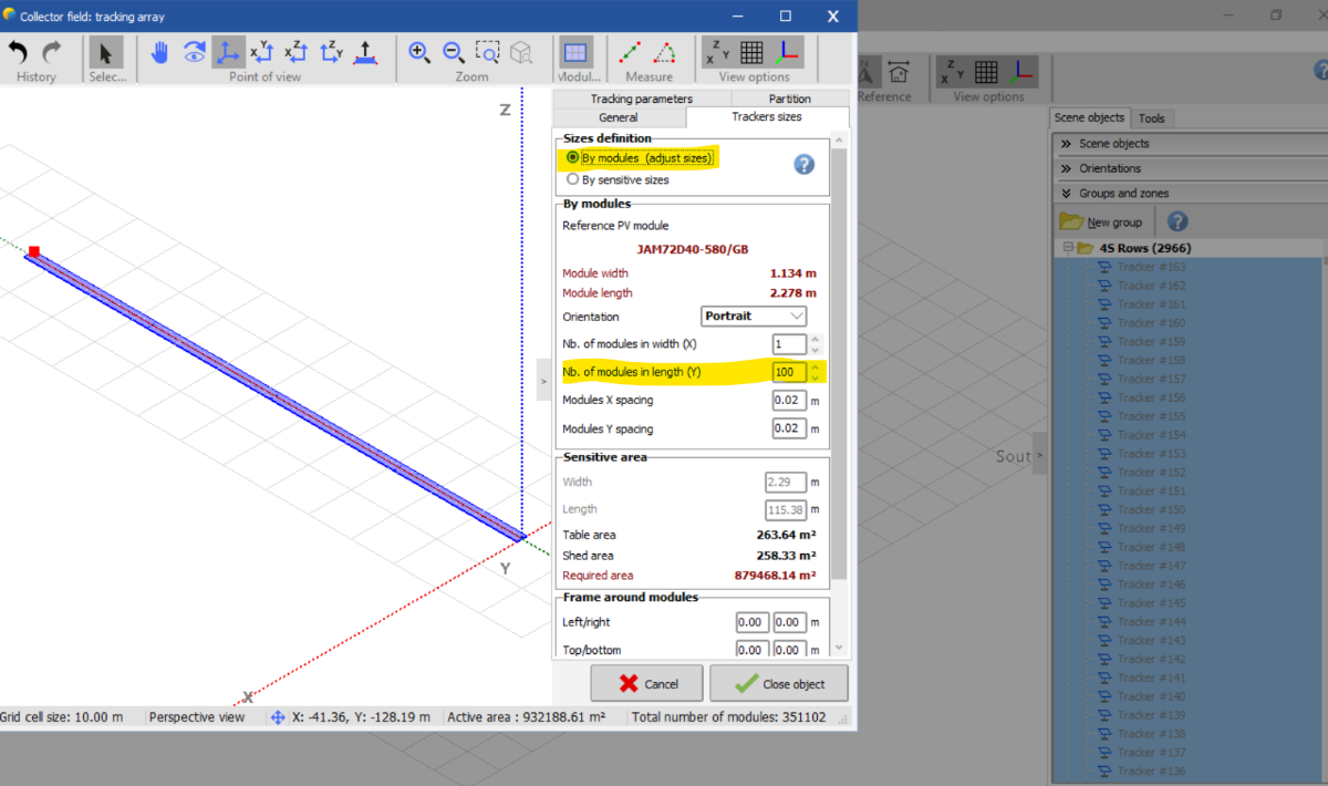
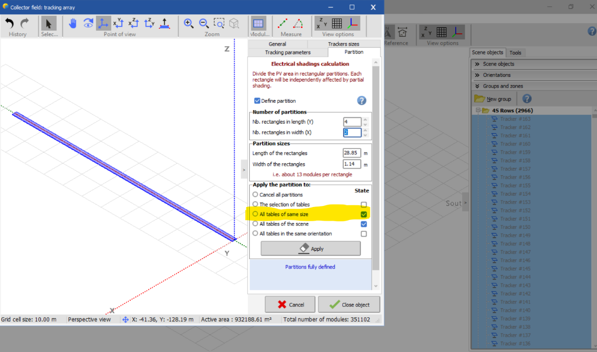
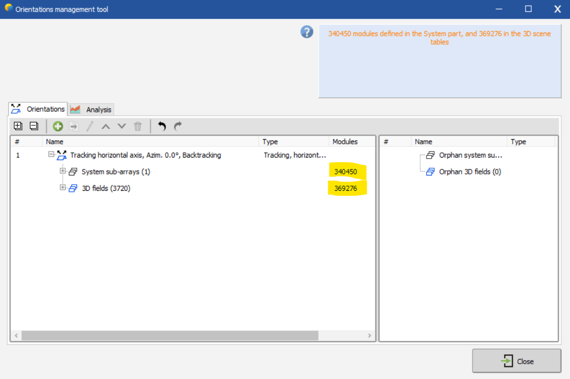
I recently updated to PVSyst 8.0. When I import a shading scene from PVCase, the row (field) sizes are larger than how many modules there actually are due to motor/joint gaps in the rows. Subsequently, with the 8.0 update, I get an error saying that there are more modules in the 3d scene than is specified in the sub array. For example, I have a row with 100 total modules, but PVSyst thinks there are 103 modules based on the size of the module and the size of the row. I am not sure how to modify a large number of these rows to align with how many modules are specified in the sub-array. Can you advise on how to align the system subarray strings/module quantity with the 3d fields?
-
I have a project that has a different GCR for half of the site. I have a shading scene that represents this as well. One half is a 40% GCR, and the other half is a 34% GCR. Is it possible to model this by groups or subarrays?
-
@Sergio Jimenez I have seen similar results. A shading scene I am using (with terrain and single axis tracking) Electrical loss acc. to strings jumped from -0.13% in v 7.3 to -3.56% in v7.4.
-
Hi there, My p90 results are shown in GWh (1 decimal), I would like to see them in MWh, or enough decimal points to use as MWh. I can't see how to export to .csv or change these units. Could you please provide help on how this is achieved? Thanks! -Joe
-
Thanks for the response! The batch simulation with various pitches ran with the .PVC shading scene without an error (this was a flat scene, with no terrain). However, I see that not using the shading scene and using unlimited trackers may be the way to go. Thanks! -Joe
-
Hi there, I am trying to run a batch simulation with various pitch (or GCR). I am wondering how the pitch in the shading scene is used when compared to the various pitches that I specify in the batch run? For example when I choose a two rows that specify the GCR in backtracking management in the shading scene, I just want to make sure that is not affecting the output of the batch runs, which would have a different GCR. Thanks! -Joe
-
I am having the same issue as @Angelov. Will look out for the bug fix @Michele Oliosi. Thanks!