Swonno
-
Posts
87 -
Joined
-
Last visited
Everything posted by Swonno
-
Thank you for your comment, It would be great if you more explain about 3D scene only, becuase I know the location but when i click the menu, The program color bar on the top became blue to gray and nothing pop up. It is really painful to edit one by one... help me..

-
Helllo PVSyst team, I am currently trying to edit those object at one time but "Ctrl + G" hot key does not pop up. Please guide me. Thank you, Swonno
-
Thank you for your reply, I got it! Have a wonderful weekend!
-
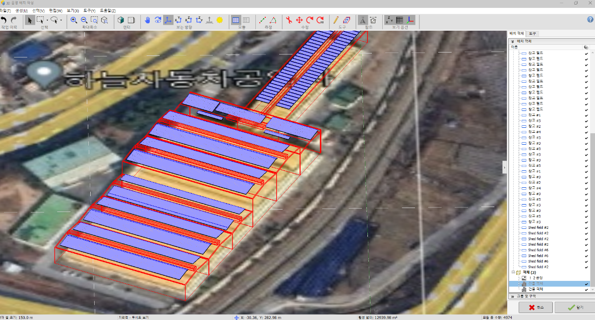
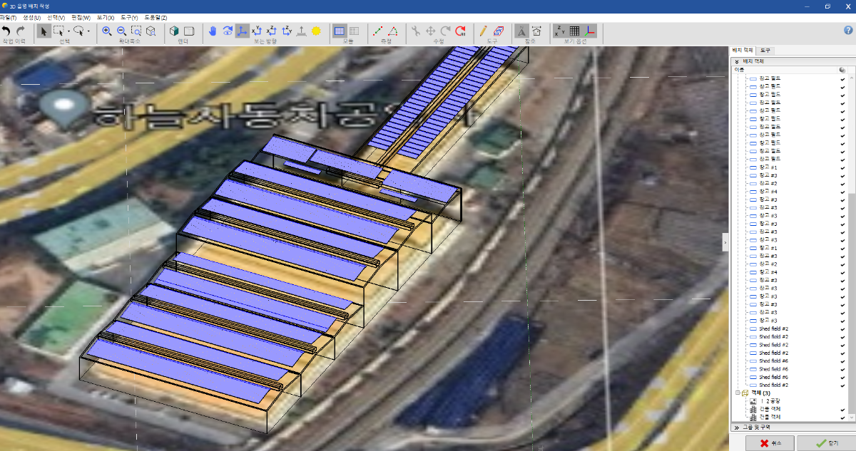
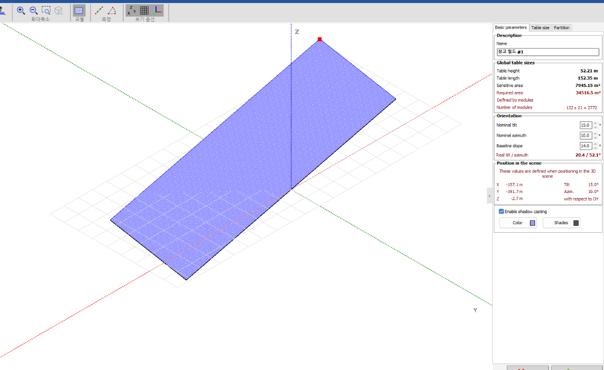
Hello PVSyst team, May I have a quesitno about zone feature ? This feature seems like appoingting area so it generates automatically tables fitting well into the area. In this phase , I'm curious is it possible that restrict capacity or module numbers so that can be close to my goal capacity. It is really hard to check the hole 3D capacity by clicking every tables and array and counting those numbers. I just select every tables and type "Ctrl+G" and click export to excel and i calculate module whole numbers in excel (because 3d Batch sometimes it does not perfectly match with system capacity.) So I'm wondering if it is possible. Thank you, Swonno.
-
This is surprsing tip! Thank you very much! My time will be saved a lot 🙂 I really appreciate your help. Have a wonderful friday and weekend. Thank you, Swonno
-
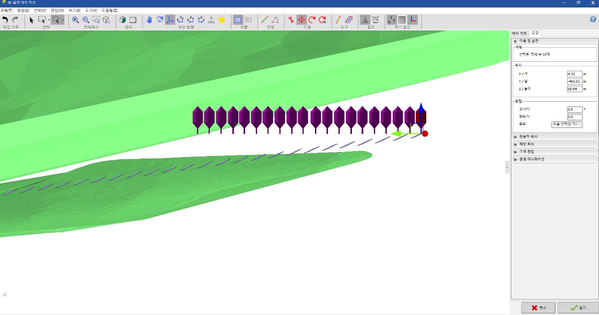
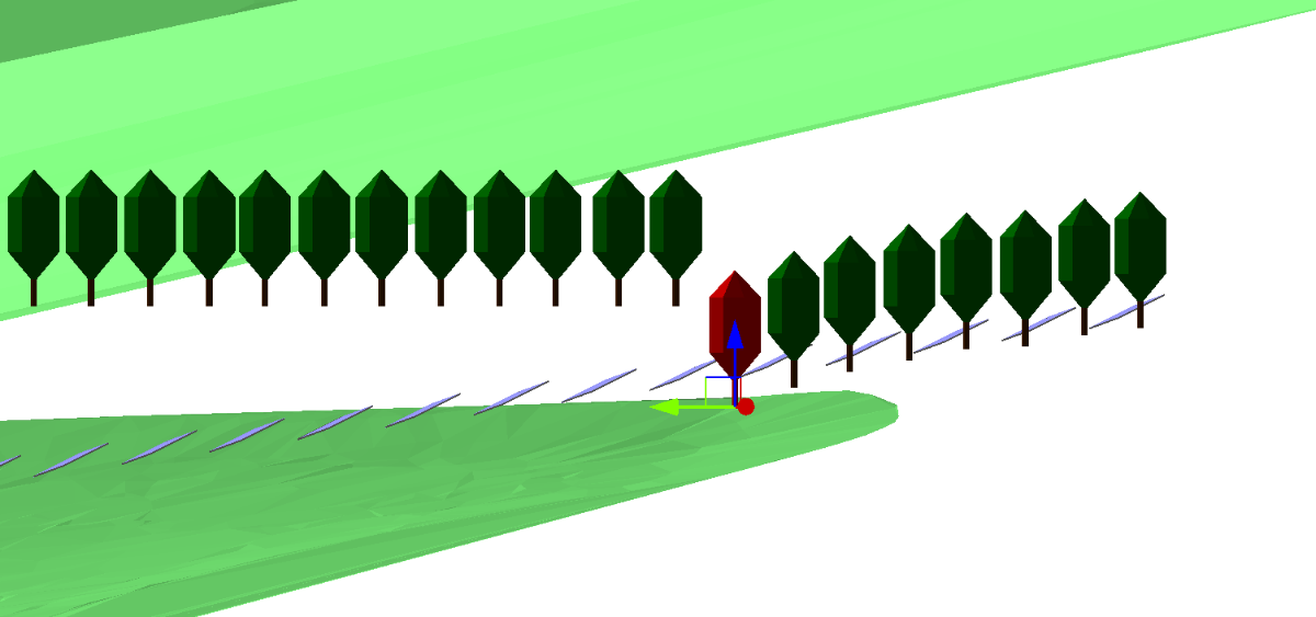
@Hizir Apaydin Good morning and happy Thursday ! I really appreciate your comment and if you don't mind i'd like to know if you can help me. I'm trying to design those tress like staired shape like a following mountain tilt. but now i'm moving every subject one by one. but in array, there is a feature array tilt. so i'm wondering if there is subject array tilt controling option to batch quickly. Thank you for your work, Swoono
-
I appreciate your solution! Thanks you very much again ! Happy Tuesday !
-
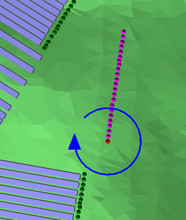
Hello PVSyst team! It`s getting hot. Drink water well and always be healthy ! Back to the topic, I'm trying to rotate the tree group but no matter what i do, the azimuth is keeping changing but, it seems likes tree group are at the same point. Is there any tips on this situation ? Best wishes, Swonno
-
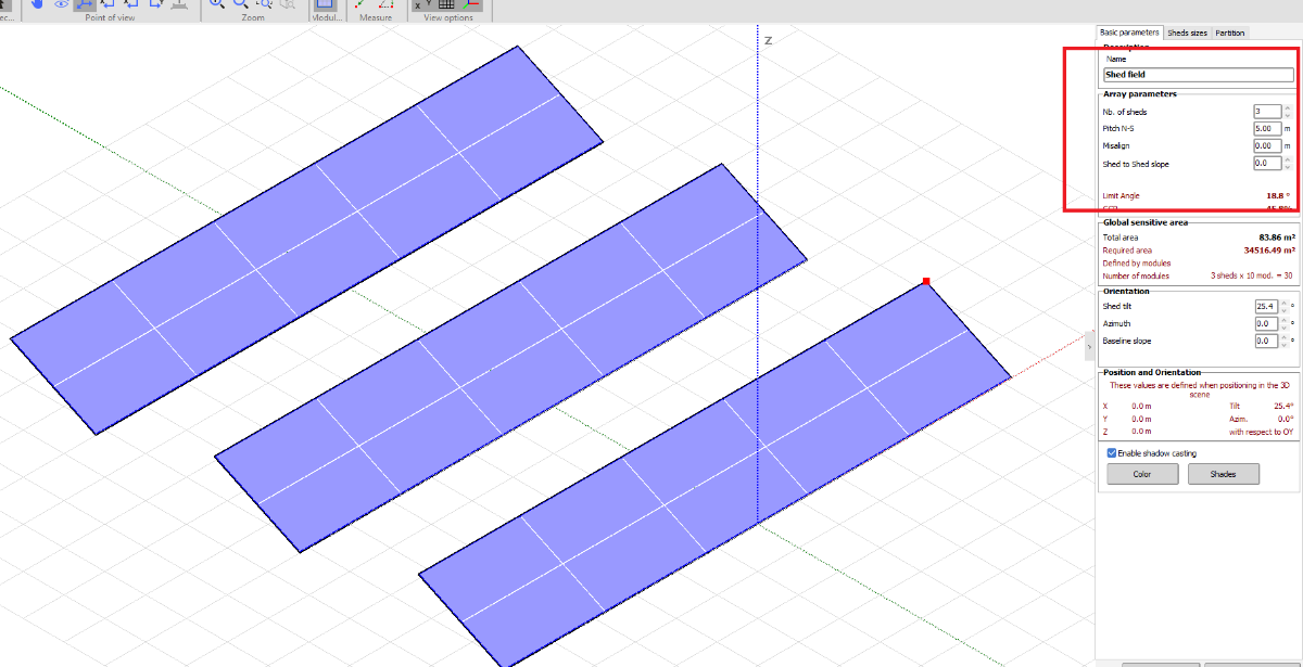
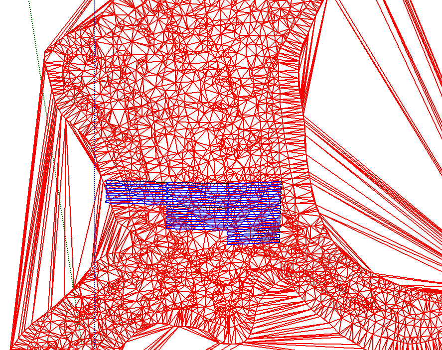
I didn't select single PV table but chose array of tables. after setting numbers of shed n to 1 and time passed, It became single module array.
-
hello pvsyst team. good morning, I'm designing arrays but suddenly , it disappeared array detailed option box on the right top. (as you can see there is no option on the right top.) but if i create another array set, i can see array moduel managing option. pls , guide me !!
-
Wow you are so sweet ! now it is so clear!! thank you very much!!! Have a wonderful weekend!! 🙂
-
you mean i can save ground object as a shading object and for next project i can add it like a block or component? thank you for your tip. Happy friday! Okay I got it, I also used rendering feature but for terrain project, it is hard to see clearly. Thank you for attention on this matter! Happy friday !
-
Oh... wow... I didn't think about that aspect of view... Thank you a lot! Hope you have a good Thursday. Thanks for your attention on this issue again!
-
I'm sorry I think I overlooked the example. Thank you for the reply, I followed your example. Now on this stage, It seems like there came another problem. The ground picture doesn't make me look at the objects passing over. Do you have any tips to handle this issue? I batched pv module in 2D draw and I wanna match while I'm looking and comparing with 2D and topograph file. Thank you for attention on this matter.
-
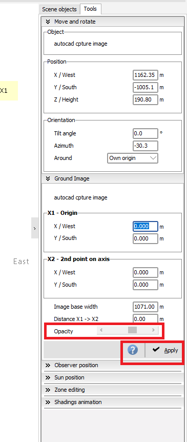
Can i have another question, I understand your point, but I don't know what does the two direction symbols mean and how it work, And if i click any point the direction symbol randomly appoint random direction, so In order to use this featuer properly can you share some example how to adjust opacity with exmaple pictures, Thanks!
-
Hello PVSyst team, Alwasy thanks for you all help. I want to focus on module location so I want to hide ground object. Is there any similiar feature in PVSyst program? Thank you !
-
I didn't realize that point, Thank you very much 🙂 Have a good day.
-
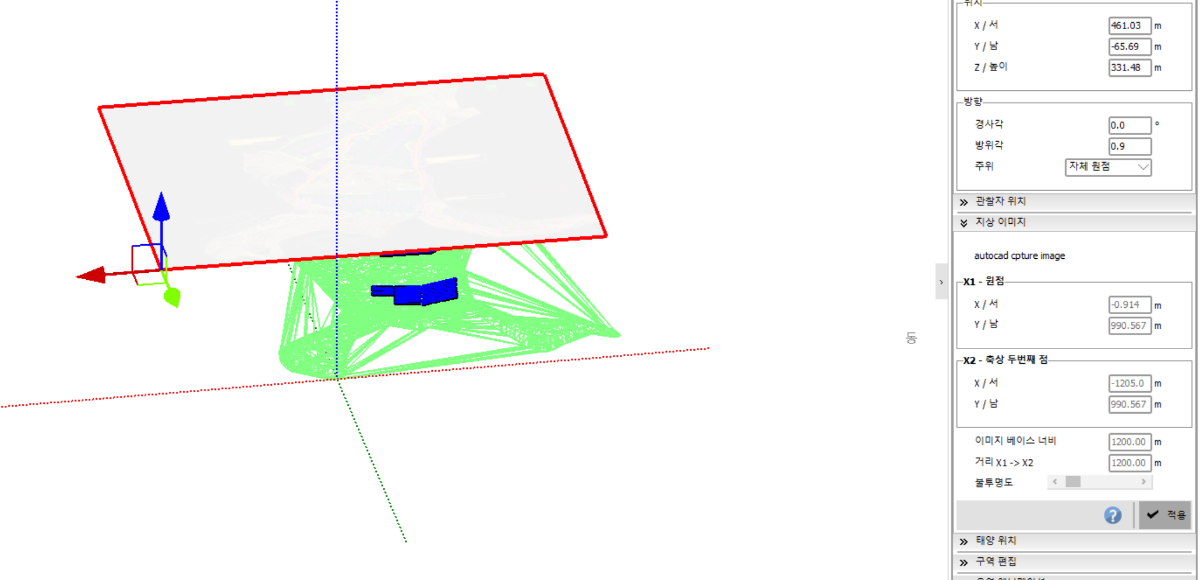
Hello PVSyst team, I'm tring to adjust opacity with image but If i adjust opacity bar and click appy, it will be disappeared or sometime its size and rotated randomly, How I can change opacity ? And also is it possible to gain google earth overlay image into PVSyst ? because if i attact image in Google earth pro with image overlay format, I can see the image spatial 3D shape but if i add image in PVSyst It is just 2D, if you have any idaa of this pls let me know.
-
Thank you for the reply and thank you for the explanation. Happy weekend PVSyst team !
-
Thank you very much! This is helpful ! Happy weekend PVSyst team!
-
I'm sorry can you guide me where to go in pvsyst and some samples? or is there any page that can be reffered? Thank you.
-
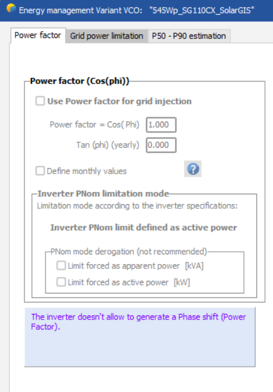
Hello PVSyst team, I tried to set "use power factor for grid injection" but I can't set it out. Do you know what option cause this error? I'm editing old project that my team member designed. and I updated conditions. But I can't set it. Please help, Thanks.
-
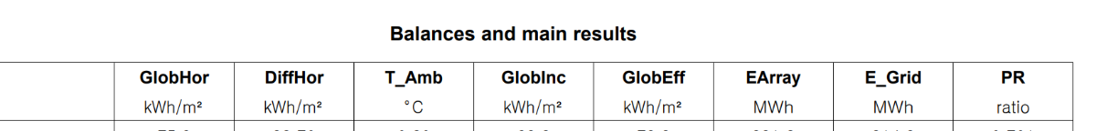
I"m sorry , let me make my question clear. I'm trying to reversely calculate GlobEff for only Jan with Loss diagram datas. How can i make the syntax for calculating? Can you guide me pls?
-
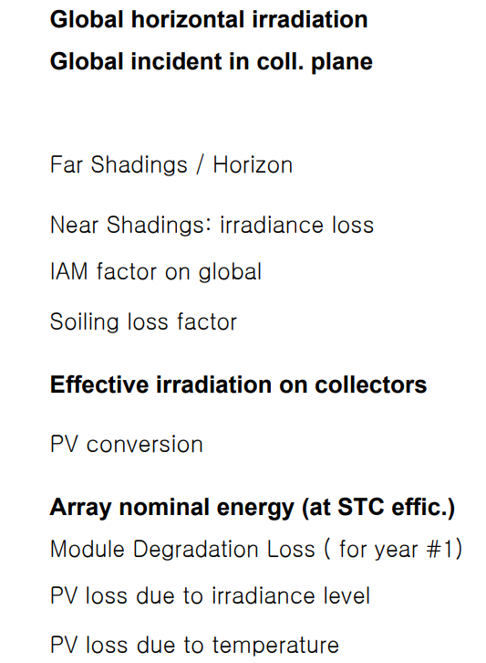
Hi PVSyst Team, I'd like to know the calculation fomula for GlobEff. For example GlobEff = GlobInc + GlobHor (It would be great if you can explain with the compents in Loss diagram like far shadings, nearshaing , etc.) Thank you,
-
Good morning Muhammed Sarikaya, Thank you for your comment ! I think my question is almost solved from your answer. So you mean, the default value of the ground object is not enabling shadow casting and It means that doesn't affect to generation hour whether how the topography is huge or small, It doesn't make any change to generation hour because it is set as a not enabling shadow casting , do i understand right? So In this case, ground object is used to show the place how it looks like, not to consider how the ground object afftect to the generaiton hour. I just wanted to know my thinking is right into the simulation and chekced. Pls let me know my ideas is wrong. Thank you for reading, Hope you start wonderful new week.