Swonno
-
Posts
87 -
Joined
-
Last visited
Everything posted by Swonno
-
Hi PVSyst team, Happy Thanks giving from Korea. Moving on the main point, There`re some situation typing in a box manually with different datas such as ground albedo, soiling losses. For a case above, When I type data monthly basis i use "tab" button but somehow it move to another box without my intention. For example, It moves to Sep to Apr , or Nove to July. I believe this can be solved easily and will give good user-friendly satisfaction to customers for program UI respect.

-
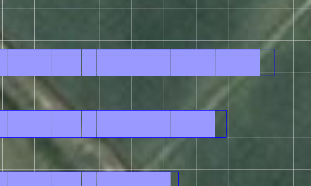
Hello I used 3d auto batch zone feature and have been wondering why there are some module transprency existed in the edge of array. Can you explain what does it mean ? and what it can affect to simulation? Thank you.
-
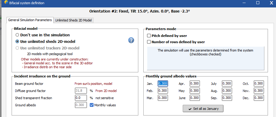
Good morning PVSyst team, always thanks for a solution.. For dome project (attached image of 3d scene), It seems really difficult to adjust bifacial system for it. An error message said, "tables width are not same" or this system is not suitable for bafacial system. Is there anyway i can reflect bafacial system for this proejct? I'm also considering to run pvsyst individually but even i did it the same error message comes out. Pls guide me, thanks
-
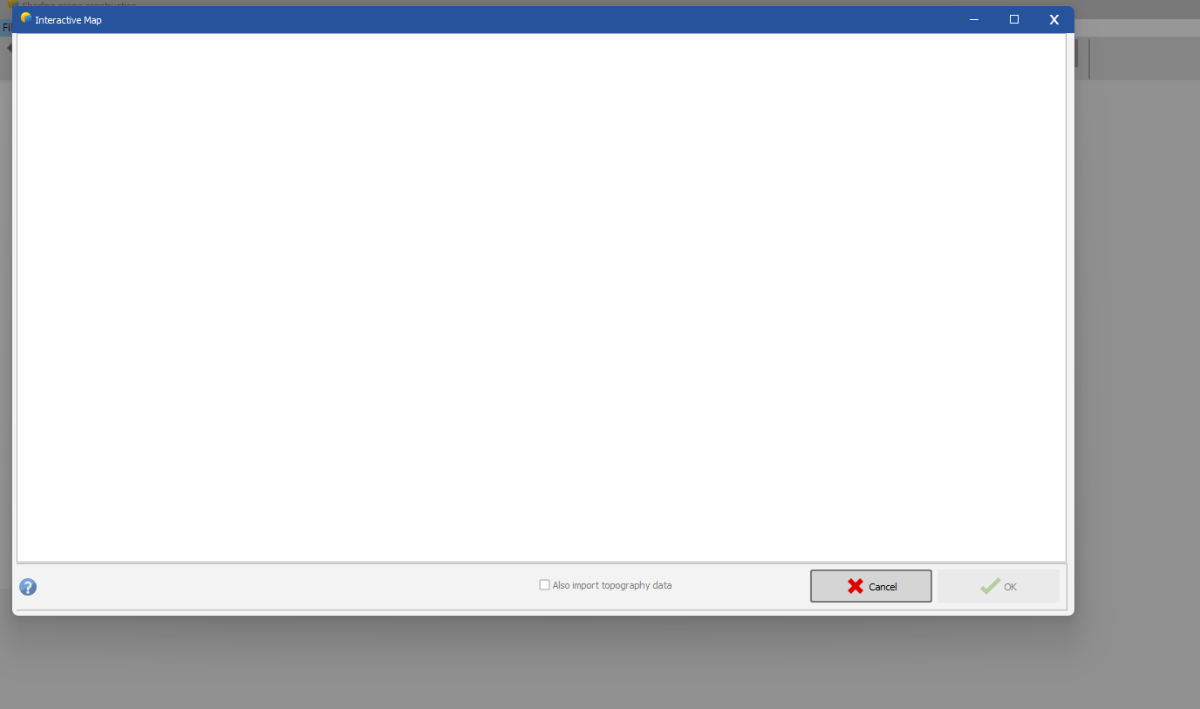
t Hello PVSyst team, I'm trying to import topology but it seems nothing downloaded well. Just looking white for few mins. Is it still having a bug or error?
-
@Hizir Apaydin Thanks, This is really helpful!
-
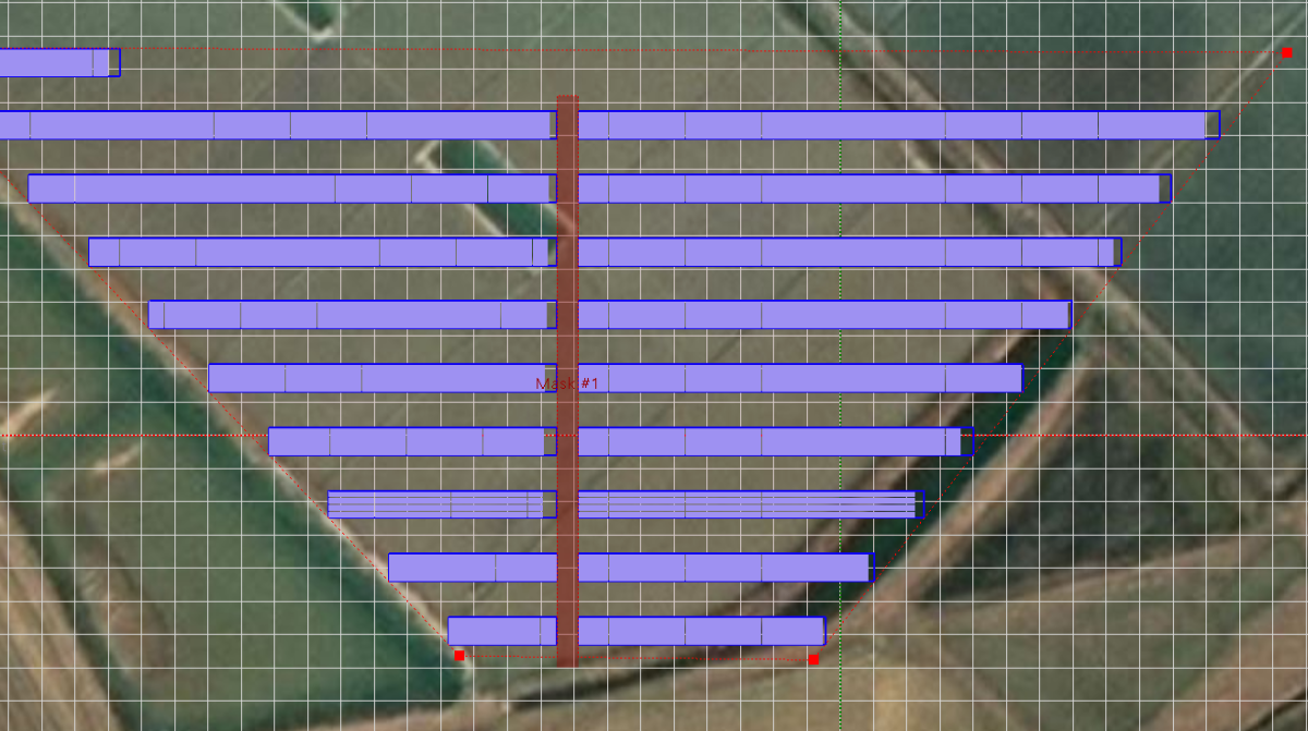
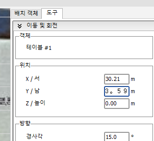
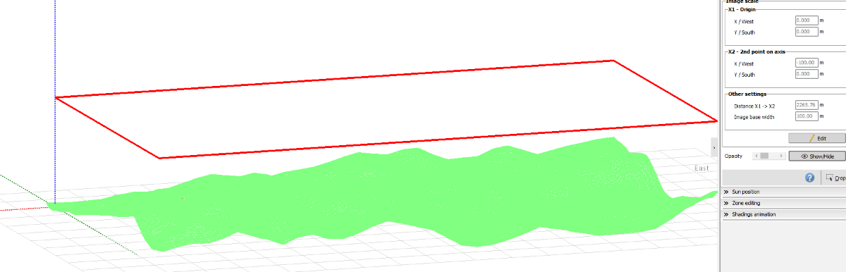
Dear PVSyst team, Hi, I'd like to study more about origin feature in 3D scene. Is there any specific explanation in doc which PVSyst released ? When I have different width rows(arrays) and use auto height adjustment feature, It seems not align , so if you have some material to be shared , Pls let me know. Thank you.
-
Or can i change the power generation unit GW to MW ? For small scale project, there are not huge gap but for large scale project having GW unit then there`s huge gap between Main result table Yearly sum data and Probability data.
-
Hi PVSyst team, I'd like know If i can change decimal basis point because there is a data gap between Balance and main result table and Probability distribution due to decimal value missing. Please let guide me. Thank you.
-
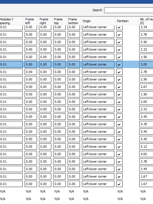
Dear PVsyst Support Team, I am currently working on a project that involves arranging 18 PV modules (9 horizontally by 2 vertically) into a single string on uneven terrain using the zone function in PVsyst. While the modules align with the terrain as intended, I encounter simulation errors due to modules overlapping or encroaching upon each other. I understand that even a minimal spacing of 1–2 cm between modules is necessary to avoid such issues. Could you please confirm whether this overlapping issue has been addressed in PVsyst version 8? Additionally, are there alternative methods within PVsyst to effectively position modules on irregular terrain without encountering these overlap problems? Your guidance on this matter would be greatly appreciated.
-
When I import some pvsyst 8.x projects , I can't see them. (I can see pvsyst 8.x project at the fisrt page but can't find while i import the project.)
-
Hello PVSyst team and Users, Happy New Year,, I'm trying to move PVSyst 8.x version these days but a lttile bit afriad of many feautres to adjust. Back to the business, I am currently using PVSyst 7.4 version to design and simulate but once I open PVSyst 8.x version at the first page I can't see previous projects that i had worked in PVSyst 7.4. Moreover, Even some projects that i worked in PVSyst 8.x I can't see also. Can you guide me how can i see the projects ? Thank you
-
Hi Jeremie, Thank you for the comment, Sorry I don't understand, Could you give me more detail explanation? Mayne it would be great if you have a picture how to set it, meaning how to make editable. I'm sorry. I don't understand'Portion of cylinder'. Thank you.
-
Hello PVSyst team, I tried to type number at y axis, but it typed it more bigger and PVSyst program doesn't read this. Pls guide me thank you.
-
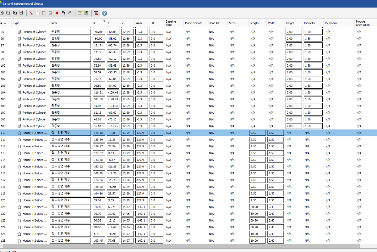
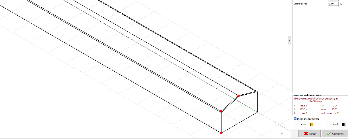
Plus, I'm trying to change House + 2-sided "height" in Ctrl + G pop windoe menu. Is there any way to enable to change this value ? It is written N/A. There are many object and It will take lot of time to change one by one. Pls guide me Thank you.
-
Moreover, I'd like to change root top floor color at once. I know how to change the color one on one but I'd like to chnage at once in Ctrl+ G option. Pls guide me thanks.
-
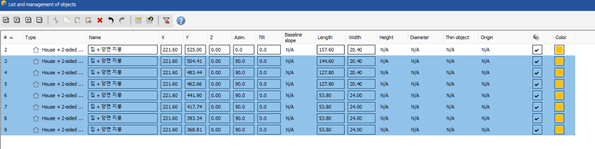
d Hello PVSyst team, I would like to change multiple subjects at once. But it seems N/A. Pls guide me. THanks
-
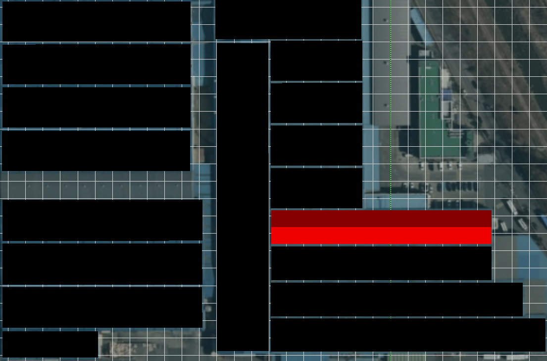
I clicked show/hide option but it just become white and can't see terrain in the top view. What if i have many images and want to match many images together ? i.e. one is PVsyst terrain image and another one is Autocad 2d batch image? Because I mostly receive 2d pv module batch. How can i use terrain with 2d batch image together? Because it is not only a problem of show/hide image but also when i can only see one object of terrain or one image becasue the image hide terrain or terrain hide image. and , I don't precisely know where is the our project site only in PVSyst terrain image. I need some more extra image to refer to know the our project site. Pls guide me. Thanks
-
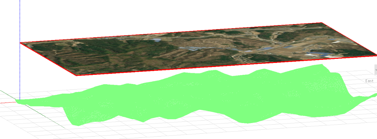
I clicked continue application button and how can i import terrain??? I hear that there is an update that i can add terrain in PVSyst. But i can't find.
-
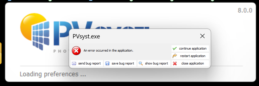
Hello I installed new version 8.0 but error message poped up like that. pls help *p.s. I didn't delete old versino.
-
You saved me thanksss!
-
Is there any tips to run the simulation? Because I succed to arrange various orientations but even small capacitiy orientation is needed to same inverter but this inverter is too oversized for this. I didn't expect this small capacity orientation.... Do you have any guide line at this situation??? Inverter size is planned for 125kW but I desized to 50kW but i can see error.
-
I adjusted tilt management degree and it works not thanks!!
-
Thank you This is helpful.
-
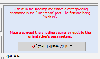
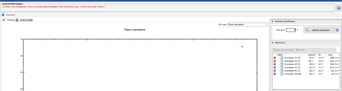
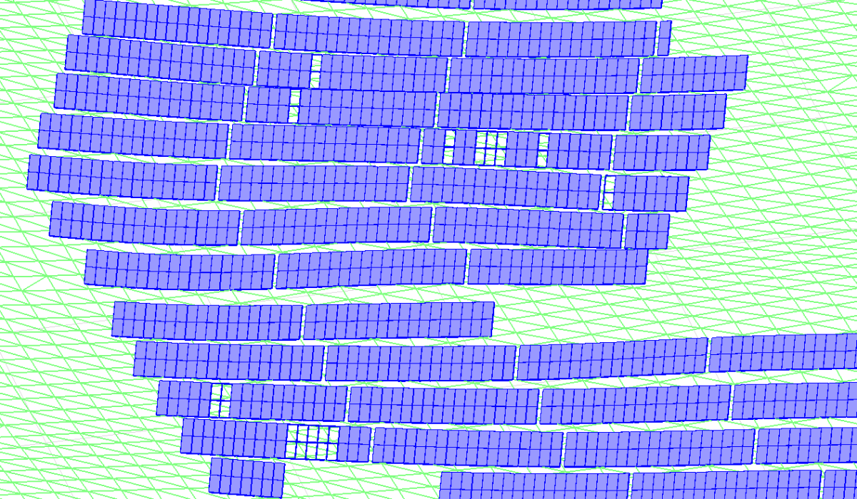
Good afternoon from Korea. Can I have a question? The Orientation update button doesn't run. So I moved to the Orientataion management tool and changed til 5degree but It seems like it`s not working. The Mesh #14 is the flat modules wich is 0degree. What can I try next? Pls help thanks.
-
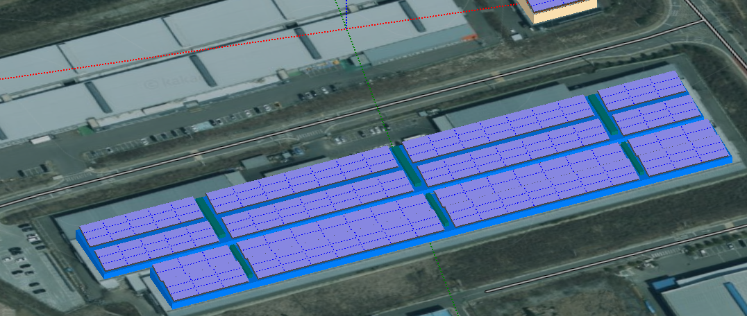
One more question is, When I import from Sketchup, Some array is wholed or transformed as a line. Pls guide me. Thanks