Swonno
-
Posts
87 -
Joined
-
Last visited
Everything posted by Swonno
-
Hello PVSyst Team, I'm using Sketchup to design terrain and modules at the same time. But a thing is when i try to export from Sketchup to PVSyst with 3DS files, I usually export in a two different files. One is only for modules and the other is only terrain file. And When I import two seperately , It doesn't matech well. Pls help how can i match those with.
-
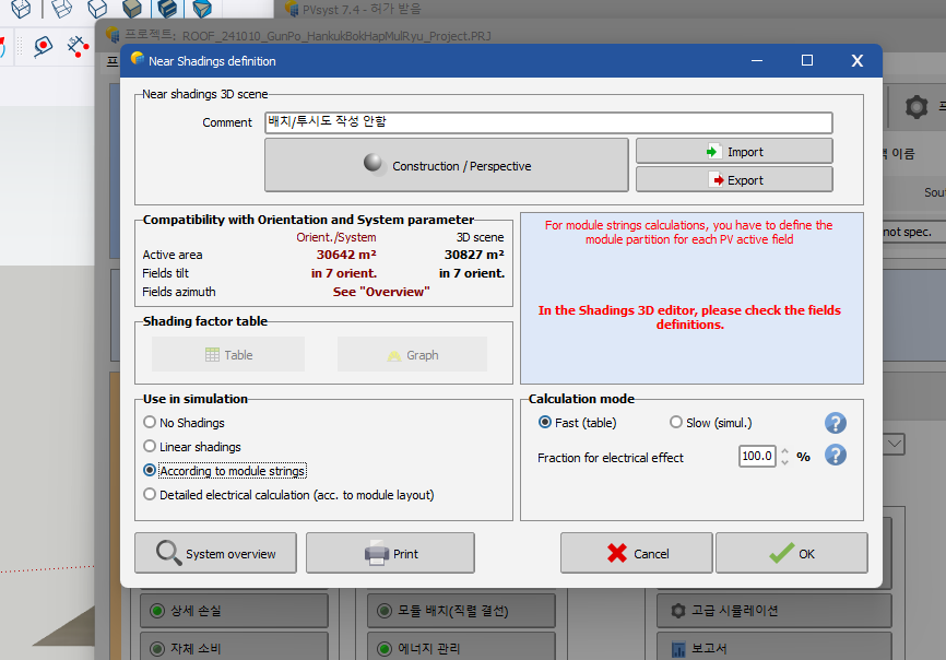
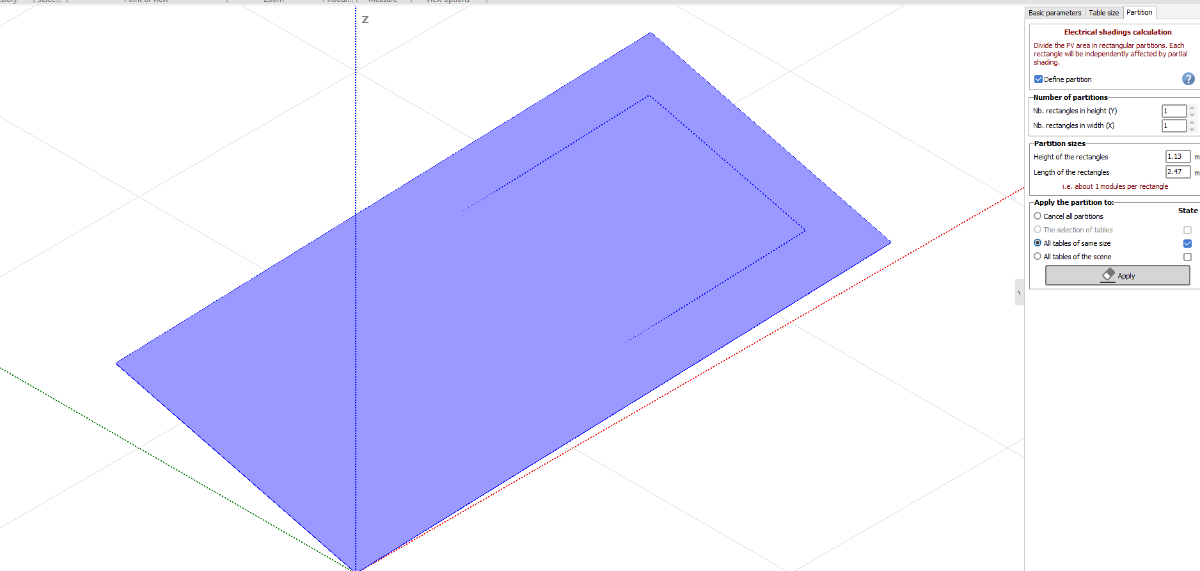
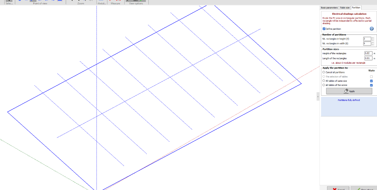
I try to adjust "According to moducle strings". However, Error message appears. I checked define partition box, Becasue while it comes from Sketchup , every arrays are divied into one segment. So I used to set with array basis for the partition but now I can see only one segment basis defining partition. I want to adjust the electrical shading calculation losses with this situation, What can I do ? I am sorry my english is bad and It might be hard to understand. If you know any idea for this, Pls help. Thanks Swonno.

-
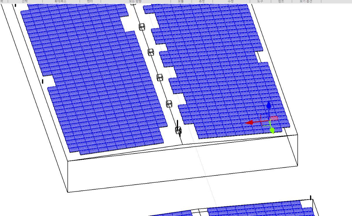
Hi Long time no see, I designed with Sketchup and imported to PVSyst with DAE file but the module is dived to one each other when it got imported to PVSyst. Here`s a problem. When I defien partition for electrical loss, I can't becasue it is small portion of size. How can I resolve this problem? Pls guide me Thanks.
-
Thank you for the comment, I understand calculating and adjusting snow case in soiling is hard. If you have any guide line for adjusting soiling losses without snow case for various cases, pls let me know such like factory area and island, ocean, salt farm. Thanks.
-
Hello PVSyst team, I would like to adjust and forecase snow soililng losses, I am planning to use Korea Weather forecast data for 20 years that Korea government provide. So, In this phase can i know how the soiling losses is calcuted or formula? I'll know annaully snowing days but I don't know how to adjust and convert to soiling losses for PVSyst. For example I know one of the korea site it snows 29 days per a year and how i can adjust to soiling losses ? (And the snow soiling losses will be combined with dust soiling losses ? I mean they are combined like plus? or just which more higher losses will be adjusted only itself?) Pls help. Thanks
-
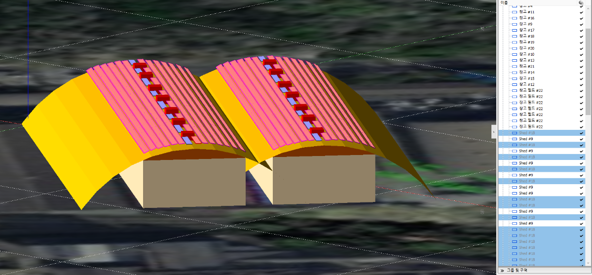
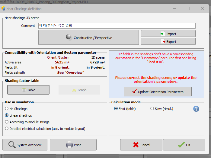
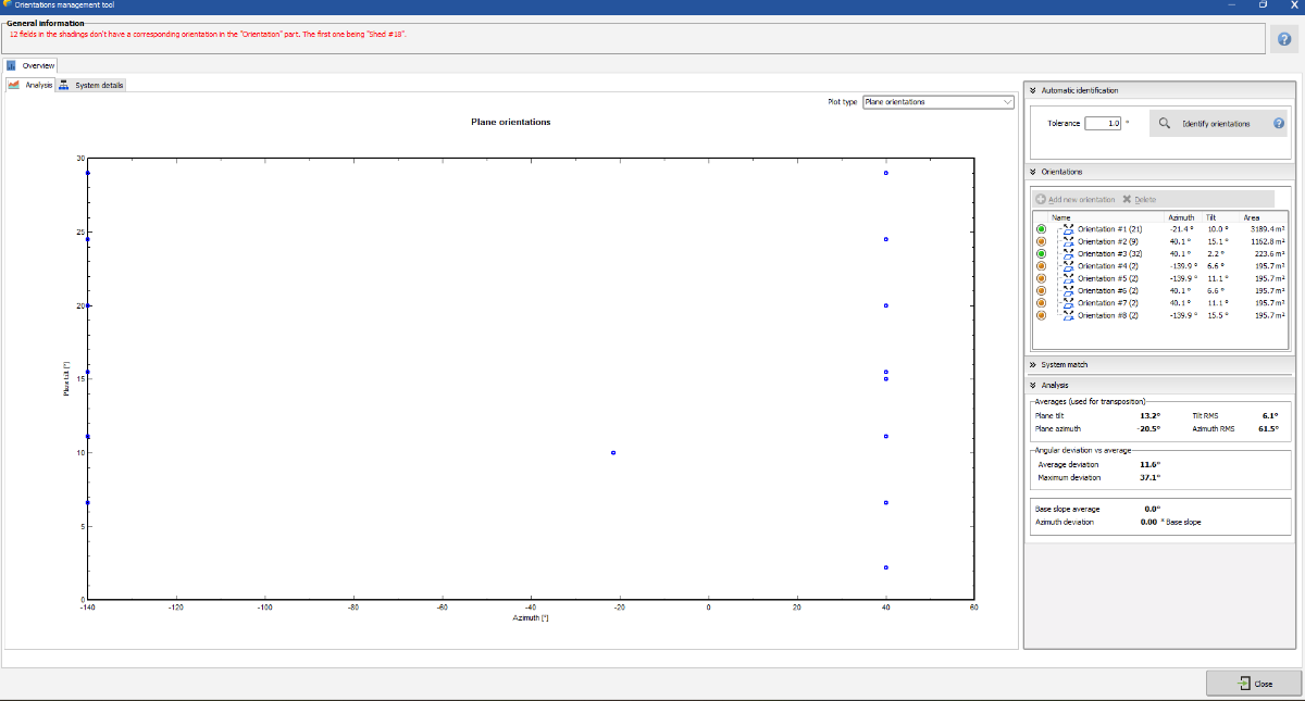
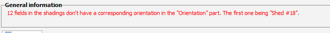
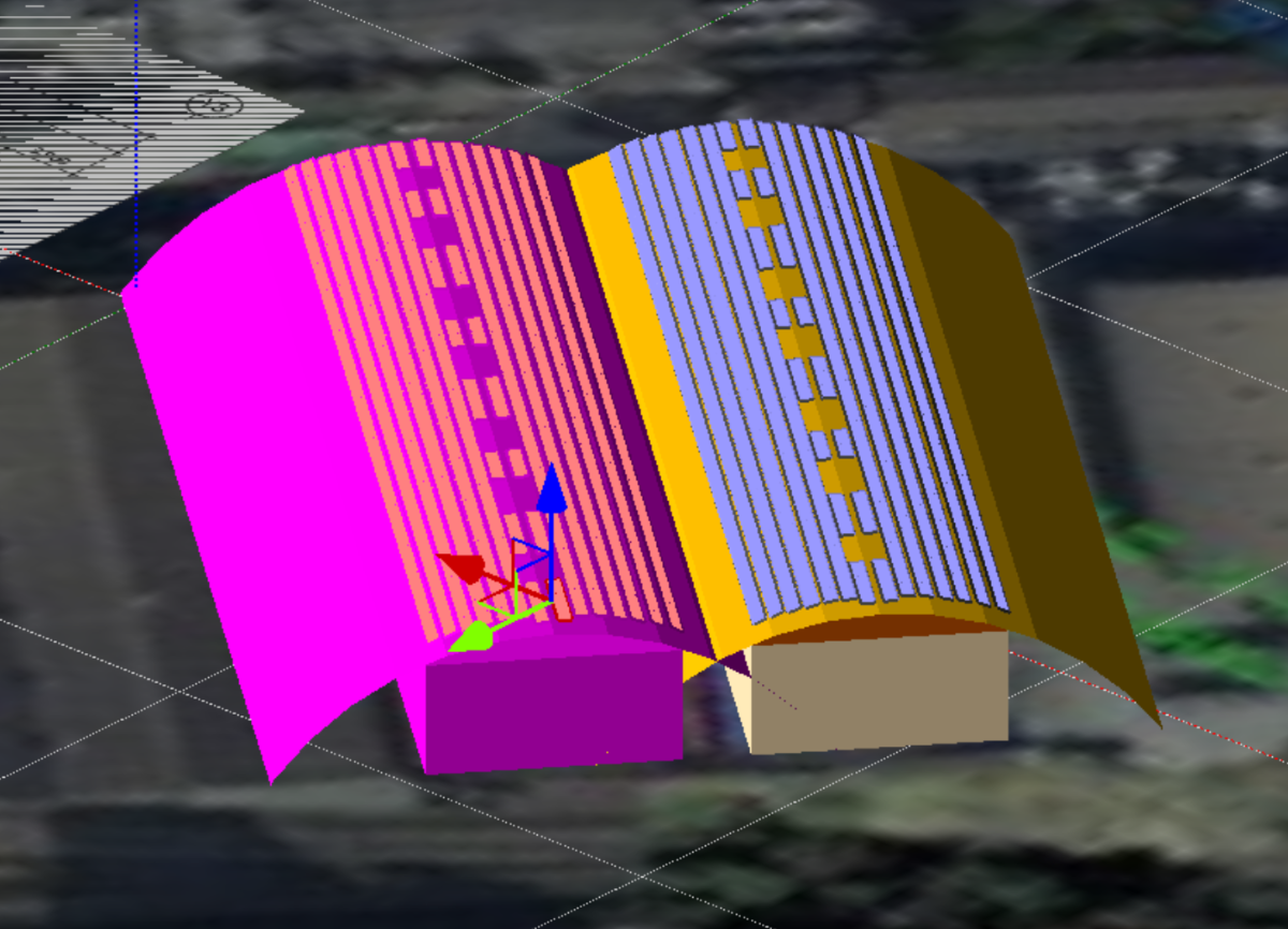
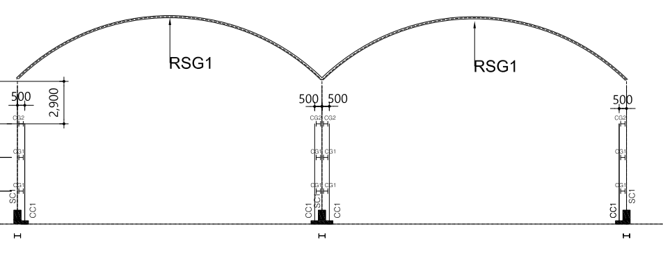
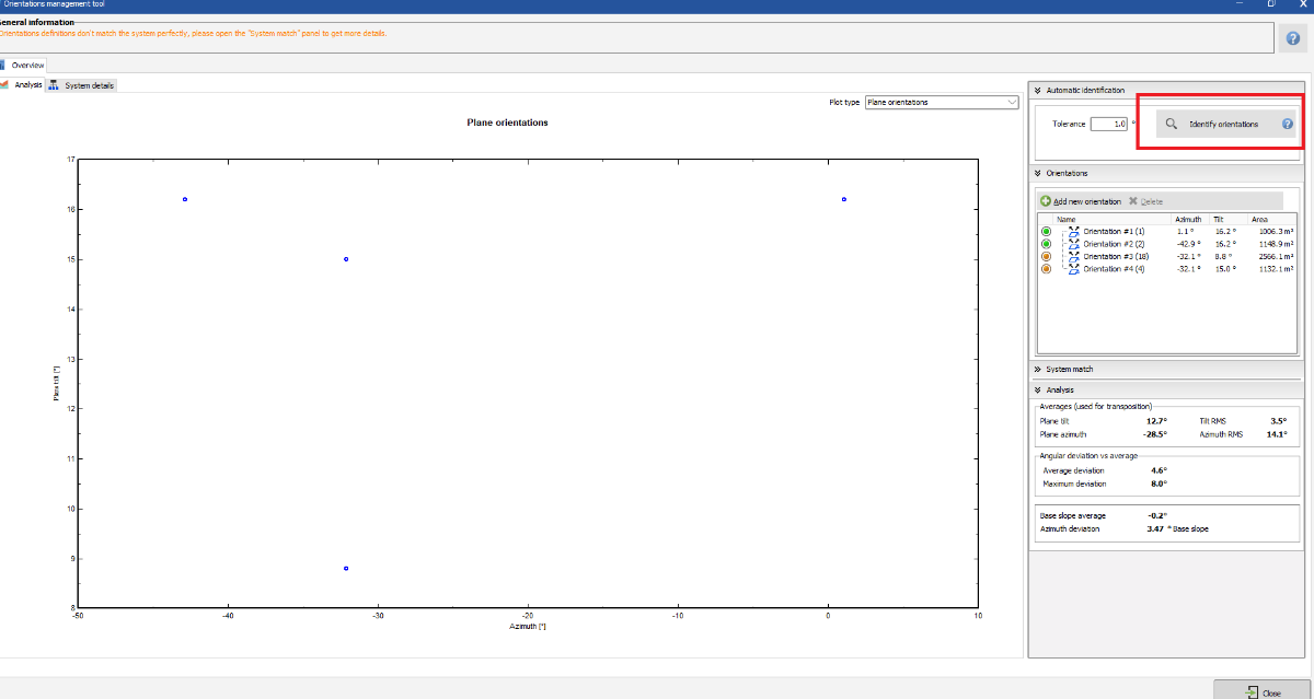
Hello PVSyst team, This is the project shading window on this topic, I don't know why There is error meesge. It appears that Shed #18 doesn't be set own direction. I clicked "Update Orientation Parameters" button many times but It doesn't work. This screen is included the shed that cause error message. The Sheds which on the circular rooftop cause error message. This is the error message zoomed in picture. I already clicked Identify orentations but I still have same error message and can not proceed to simulate this project. Pls help. Thank you, Swonno
-
Good afternoon, Based on your tip I succeded to realized it with smiliar design. But I used some trick. Anyway, I understand what your point is, Is there any suggestion tutorial that what you told me? I mean can you give me any tutorial video link what PVSyst officially provide,? I mean what tutorial video it will be better that i watch? (I have been used this program since 6 months about, and now I want to deeply more understand how it works, like engineering conecept thing for design better way and get report propery, as a financial analysis purpose) *ps In Korea, because of the small land We mostly more care about the efficiency than other country that`s why i try to more draw detaily, we barely have land to build. But you said there are not that huge gap, I mean it affects low so thank you for notifing that info. I think it will take more less next time. Thank you , and sry for my english . Have a good weekend. Swonno
-
Thank you for your answer, But all of sudden I recognized that this is not a circle, but an eclipse. It seems like PVSyst doesn't support to realize this. If you have an idea pls share. Thank you.
-
I tried to make similar shape with the draw but The angle is diff. The roof angle should be looked like someone step down by their foot.
-
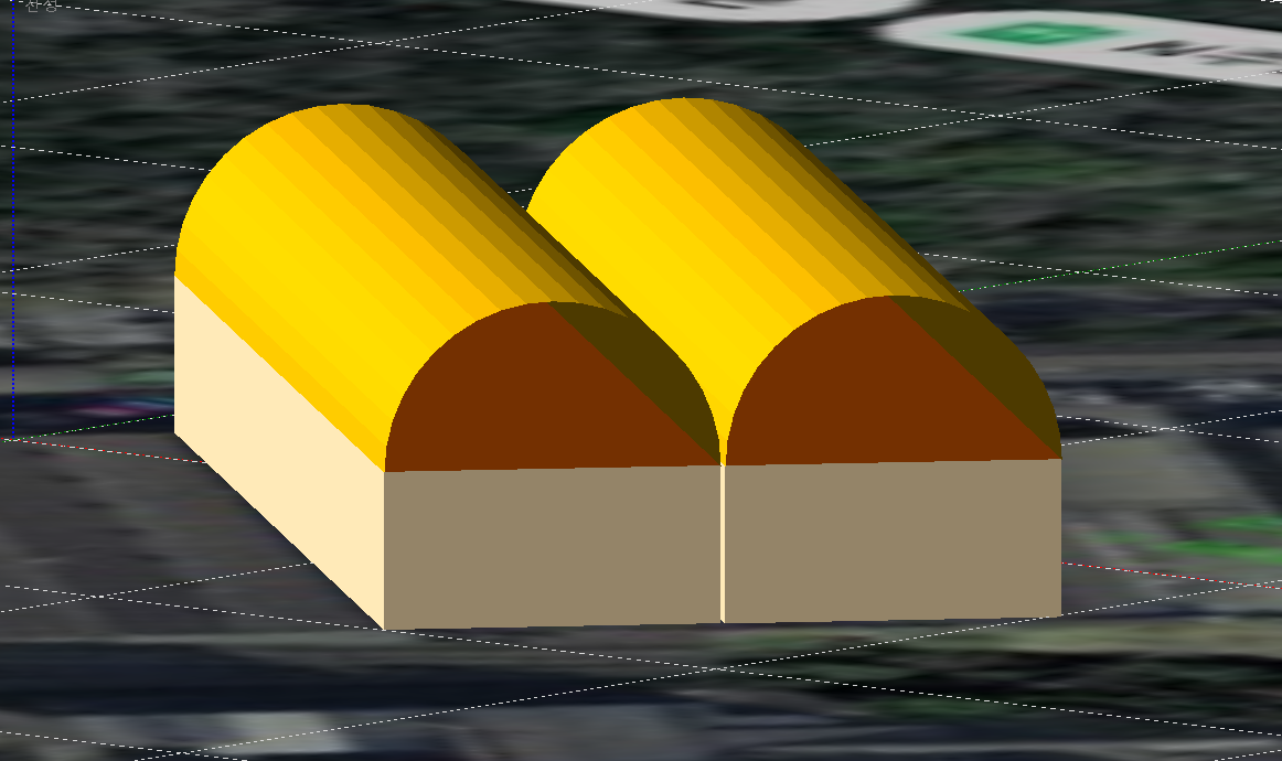
I found one named cylindar shape but It appears only in hoziontal way, not vertical way. Can I shift in a side way so that I can put it on the top of the building and so It will look like a roof top of the building, Or If you have another idea please share. Thank you.
-
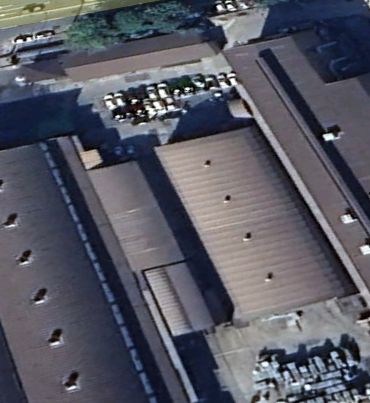
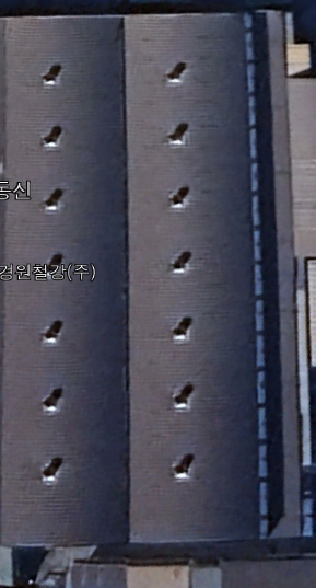
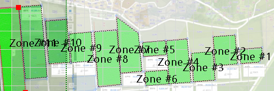
Hello PVSyst team, It`s been getting hot temperature these days, Hope y'all health and condition fine. I have a question, Is there any feature or tip for near shading design? FYI, This is the part of draw and site map, you can see below : I have no idea how can i draw that and realize it in near shading design. If It is possible that you can help me, pls guide me. Thank you.
-
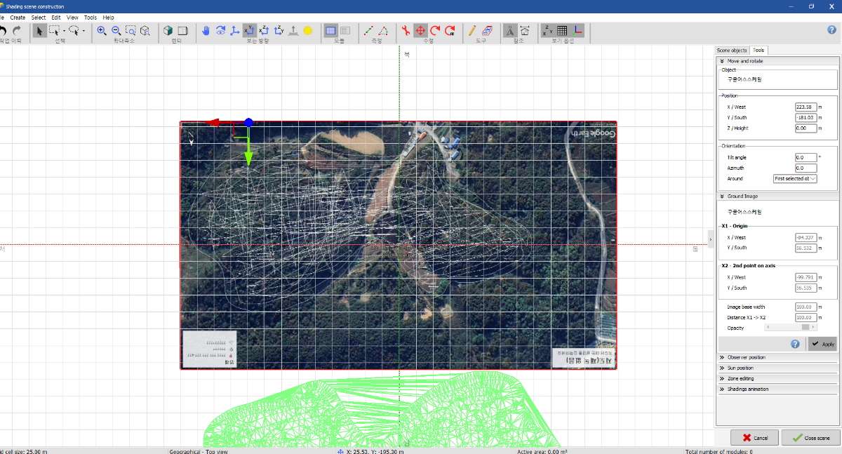
Hello, I added an image from Goole and adjusted distance between X1 and X2 but It reversed upside down. Is there anything that i did wrong? Pls help Thank you. -------------------------- problem solved, The azimuth was automatically set as a 180 degree since i attached csv filed and adjusted 180 degree. thank you !
-
I appreciate for your comment. Thank you. Have a good day 🙂
-
-
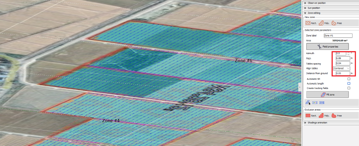
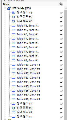
Whenever I define zone, I have to define specify table distance and tilt, any other detail datas. But what if i make many zones and want to use same detail datas? Is there any tip for this? Thank you for getting attention on this matter.
-
Hello PVSyst team, Have a good new week days. Back to the business, In my project, There are many zones but It is really dificullt to set same zone setting again and again. So, I am wondering if there is feature that can replace same setting data to every zone or zones that i want to adjust. Fyi, I attached images. Thank you.
-
Thank you for guiding me, I clicked the red bot which is "Identify orientations" and got an alert that is written which is you will be reset your all orientation something like that. Now the error message disappeared. Thank you have a wonderful day.
-
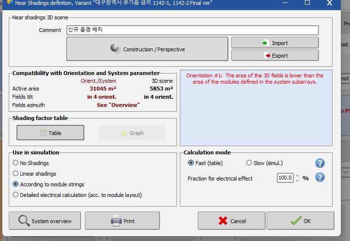
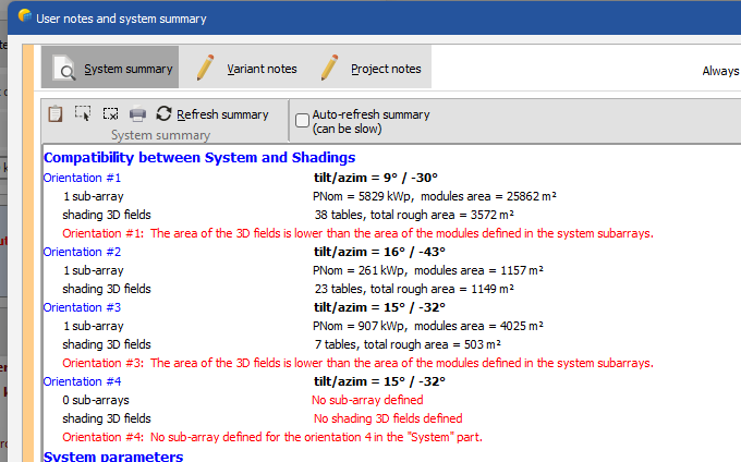
Hello Muhammed, Thank you for the explanation. This is the way that i usually do. For single dialection, I priorize system setting capacity(series * strings) that i set when i make a project. For multi dialection, I set system for capacity but PVSyst wants me to define and set each single dialection and capacity. This case will be multi dialection. I have to define dialection but the way that i check and set each multidilection is that check system overview part of written 3D batch area and system area. And I do refer 3d batch area and match with system. but in this case, i can not see any area defined in Orientation 4 in system overview.
-
Hello PVSyst team, I'm having error message so that can not simulate the project. Since i created table using zone feature , I think it happend. Orientation 4 was not defined in 3D batch but how come the error message keep pushing me to define in the system. Please guide me. Thank you, Swonno
-
That should work for my ! Thanks !!
-
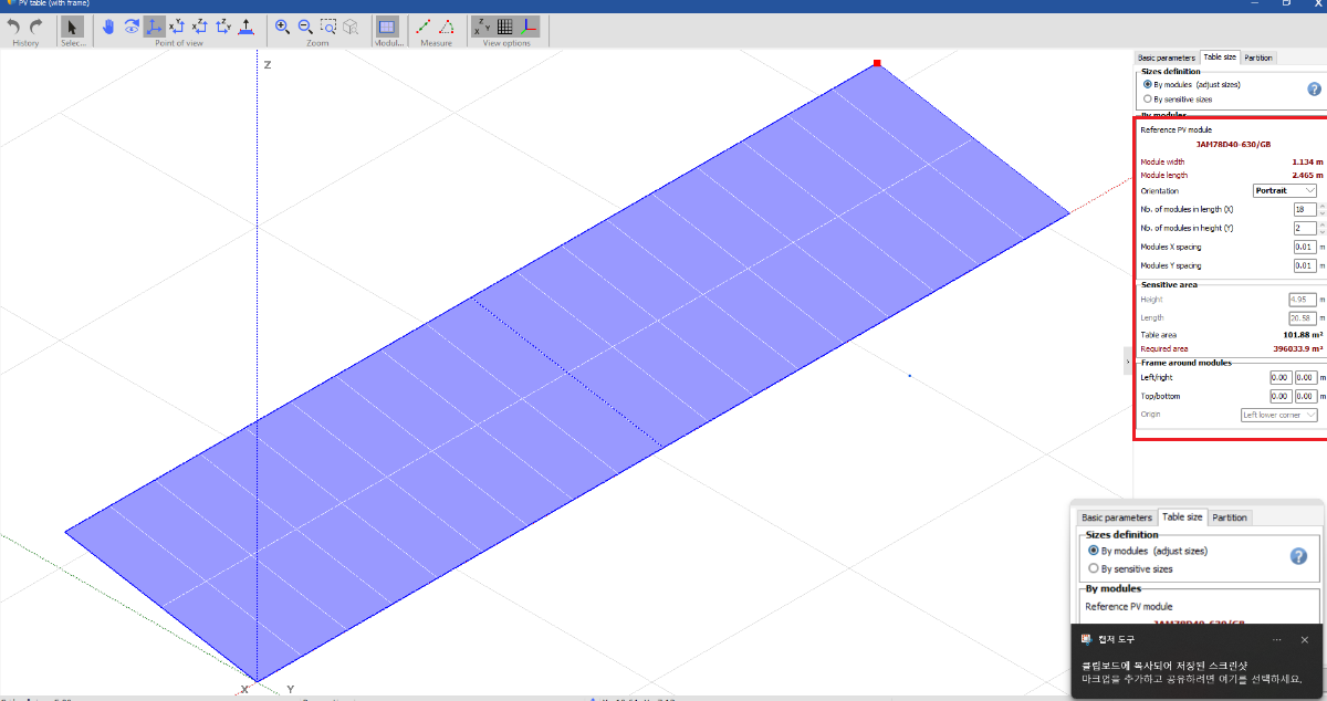
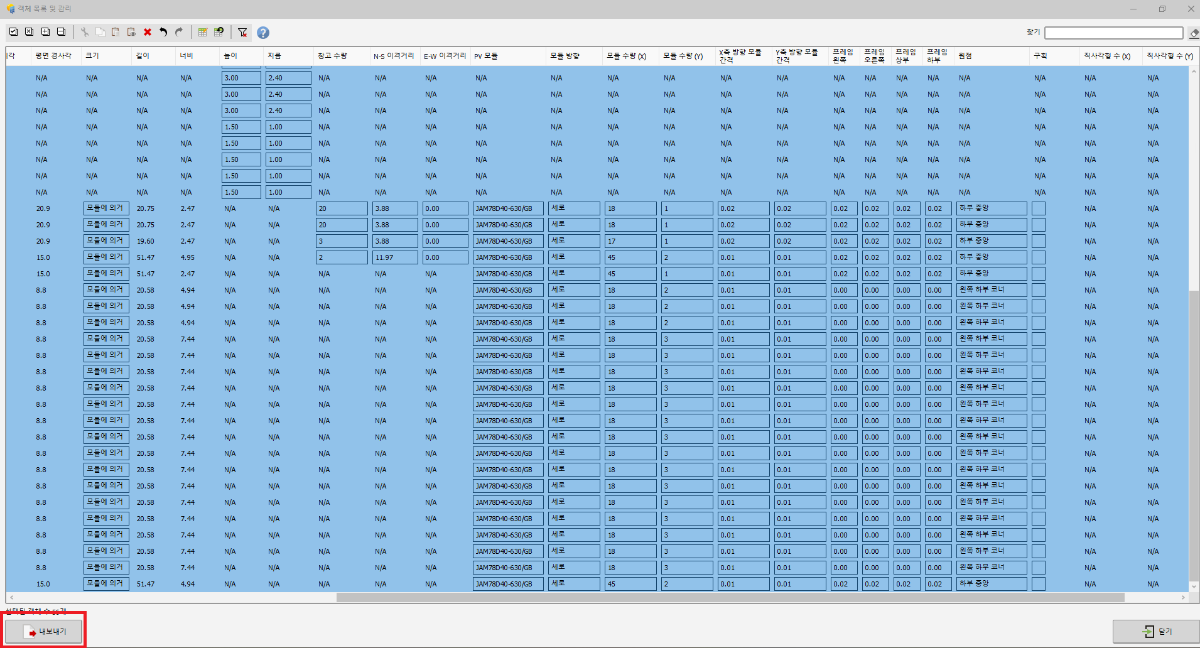
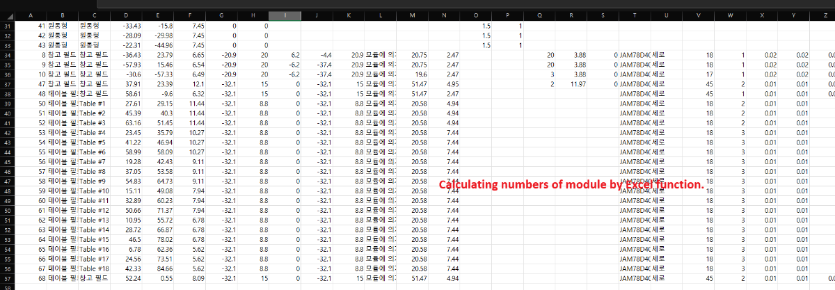
Hello PVSyst team, May I have a question? Recently , I adjusted to create modules and tables with zone feature. But I am wondering that this is perfectly matches with 3d batch modules whenever I compare PVSyst simulation report`s system capacity and module numbers. (Or maybe do you know how to filter the tables and moudles that i can only see modules and tables? I think I can see only modules and tables without zone feature created table, I can't include them to my filter which is in Ctrl + G pop window. If I can select all easily It will be great !!) So my thought is that not 100% same but it`s similar. So In order to match system capacity that i set before, It can be a way if i change system string`s and series numbers even it doesn't match with real contruction design. (I'm curious it affect criticaly to the simulation report.) Now I'm currently using this method to calculate numbers of module. I'm not sure this is the best method. If you know any better method pls share , thank you. Always thank you'all help, Swonno
-
Thank you for your guide, Hope you have a good night !
-
Hello, first, thank you for your kind explanation. but is it okay to not writing down image base width? only typing x1, x2 distance is all good ? and you said y1, y2 has to have same number but i'm wondering y1 y2 value has to be connected with x1, and x2 and vertical? or is it okay with any number? thank you for your attention on this matter. Swonno
-
Hello again, Hope you have a wonderful days, May i have extra additional question ? Now I know setting orgin x1, x2 and having same y1, y2 value And this phase I'm using google image but Can you give me a tip how you usually estimate image base width in google earth? I mean how do you know the image base width ?? Thank you, Swonno
-
Hello PVSyst team, Sorry for making you confused, It was my fault, I used 3 diff monitors and whenever i disconnect and connect many times, the program ctrl+G pop screen was minimized and hided hiddenly, Sorry about it one more time. Have a good Tuesday, Always thank you'll help. Thanks, Swonno