Carlos Arredondo
-
Posts
5 -
Joined
-
Last visited
Everything posted by Carlos Arredondo
-
After the latest PVsyst update, I can no longer find the auto-detect orientations tool. When defining orientations from the selection, the software creates nominal values that differ from the average values of the selected objects, and these nominal values cannot be edited. I would like to understand: Why the nominal values differ from the average values of the objects, How to correct or align them, And how this difference affects the energy yield and overall model results. Any guidance would be appreciated.

-
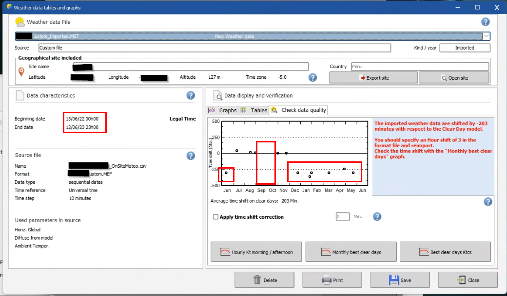
Hi all, I have a 10 min step time-series from 06/2022 to 10/2025. I also have a couple of missing months and values in between because they are real and filtered measurements. when I "import and generate weather data" from "custom file" I created the MEF that fits the format of my CSV meteo data file. When checking the data quality only one year appears and appears with the missing months from that year, even when for the following years I had enough data to cover the hole. I also have significant outliers in time shift. I know my data measurements are limited to be considered as representative, but why does the model discard the info after the first 365 days?
-
Is there a way to use mixed orientations with numbers different than #1 ad #2?
-
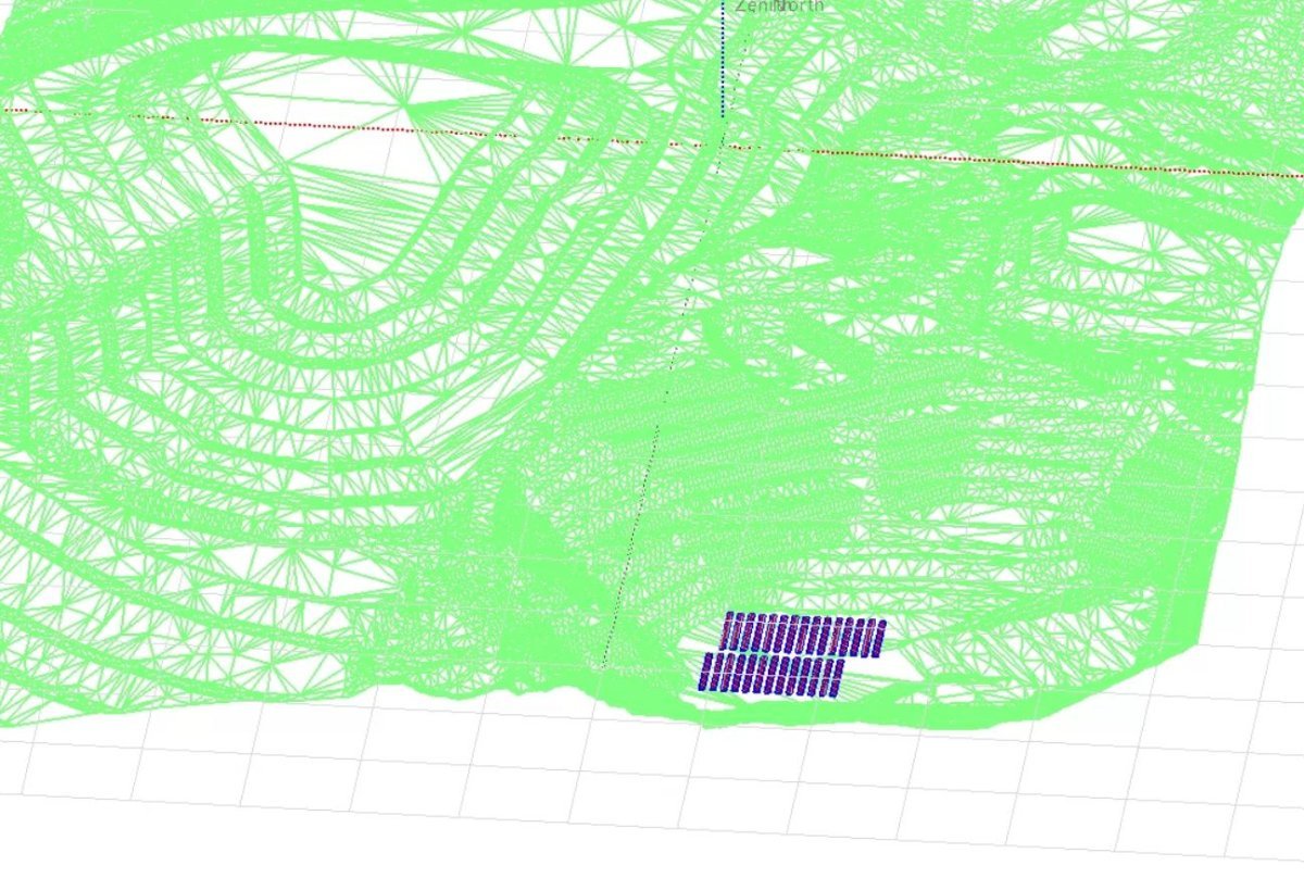
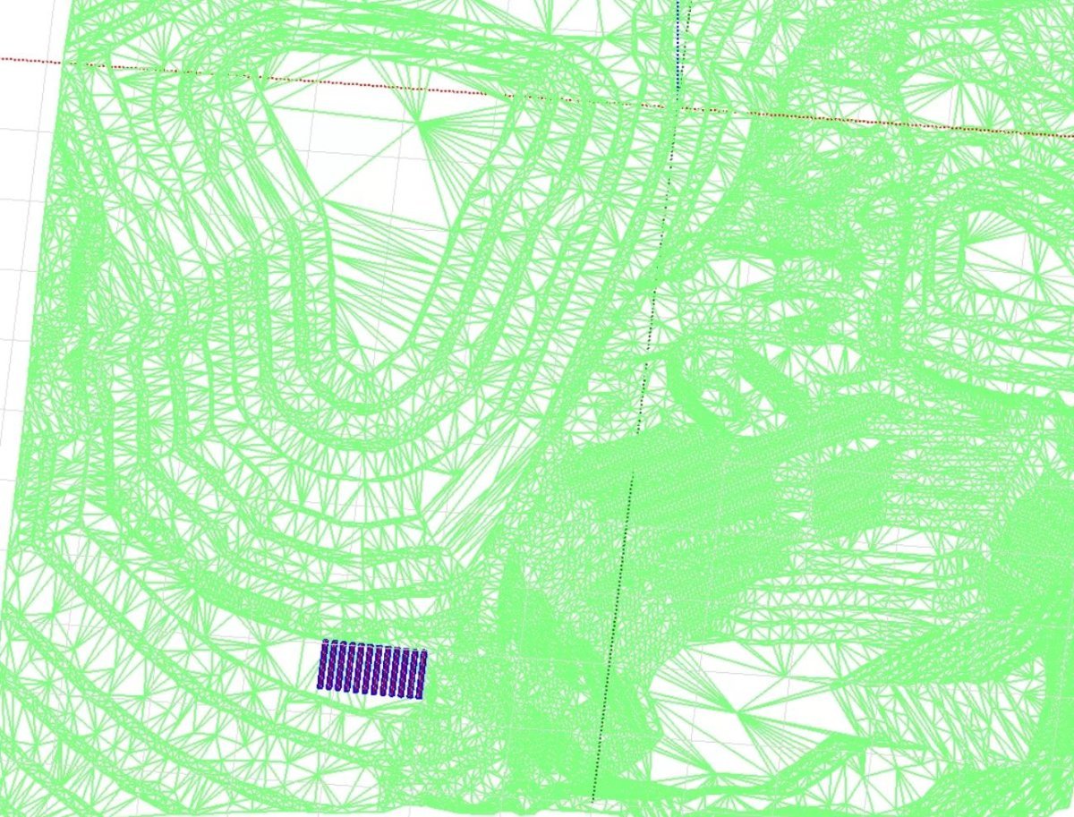
Hi, I usually build the 3D scene for new ground mounted projects using a commercially available tool that exports the layout as PVC file and direct imports into PVsyst 3Dscene. this is very fast and useful for trackers. but now I want to evaluate the near shadings of an existing plant (with trackers) with the drone scan and Metashape postprocessing. How do I "assign" the tracker characteristic's to the imported object? is there a preferred file format for pv objects, shading objects and terrain? is there a recommended procedure for this real 3d Scene mounting on PVsyst? is there a recommended software or tool?
-
We want to study the impact of the shadings of the ground in the pv objects, but when reviewing the shading factor table, it is full of zeros or very low values, that makes us suspect that the shade produced by the ground is not being considered. The horizon seems to not consider these ground differences because they are man made and too close to the pv field. How can I consider the shade of the ground? (consider this project is located in the south from the Ecuator)