Hi Everyone,
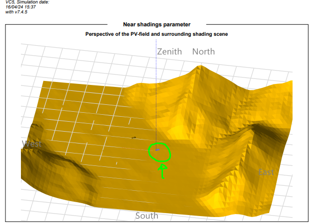
I have a PV Project located in a valley (in the green circle), in between a few mountains and my questions are :
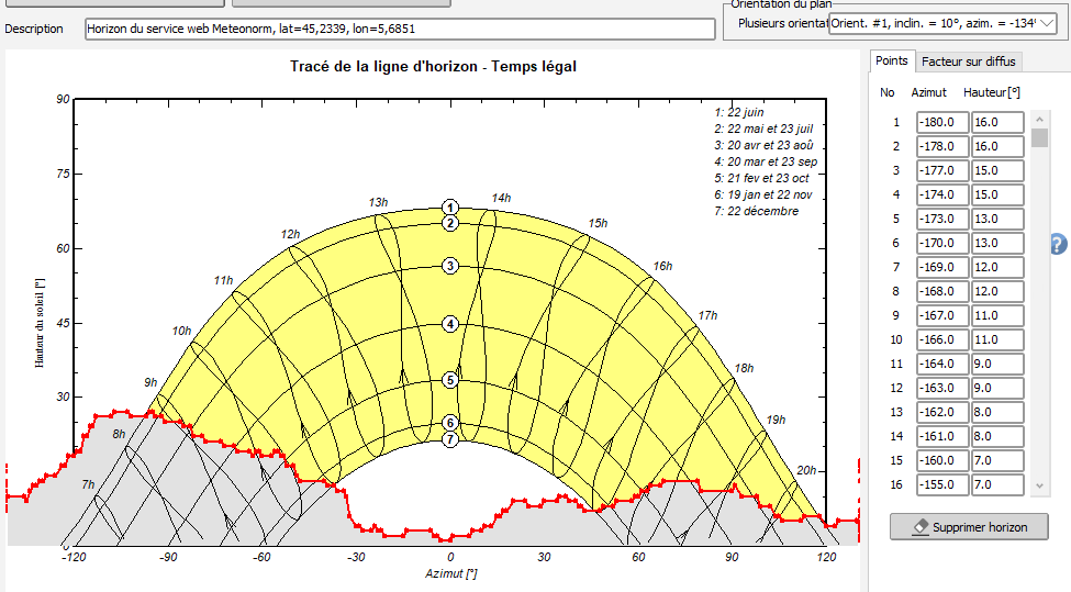
- How do I make sure/know that the losses due to the mountains are accounted for? Is it already accounted for when I import my Meteo Data ?
- Do I have to do like in the image I uploaded? meaning, If I know my PV project is located near tall mountains, should I always import the topography or am I penalizing further my results?
If anyone could help me or knows where I can find these answers, I would very much appreciate it.
Thanks again