Hello, i'm using pvsyst 8.0.3.
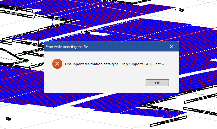
I'm trying to import ground data in shading scene construction. When i select .tif file (GeoTIFF) pvsyst return this error: "Unsupported elevation data type. Only supports GDT_Float32".
I export the .tif file from software Global Mapper. I searched this problem, but didnt find any solution and sincerely, i dont have any idea how to solve.
The pvsyst documentation has a short content about importing GeoTIFF Ground data. Can someone give me a hint, please.
Thanks, MA.